
Gujarat Tour Diary: Day 05 | Statue of Unity, Stambheshwar and Narmada Dam
(If you have come to this page while searching for some travel related information of Gujarat, I suggest you start from Day 0 of this travelogue.)
The first place of the day was at Kavi Kamboi, around 80 kms from Bharuch city.
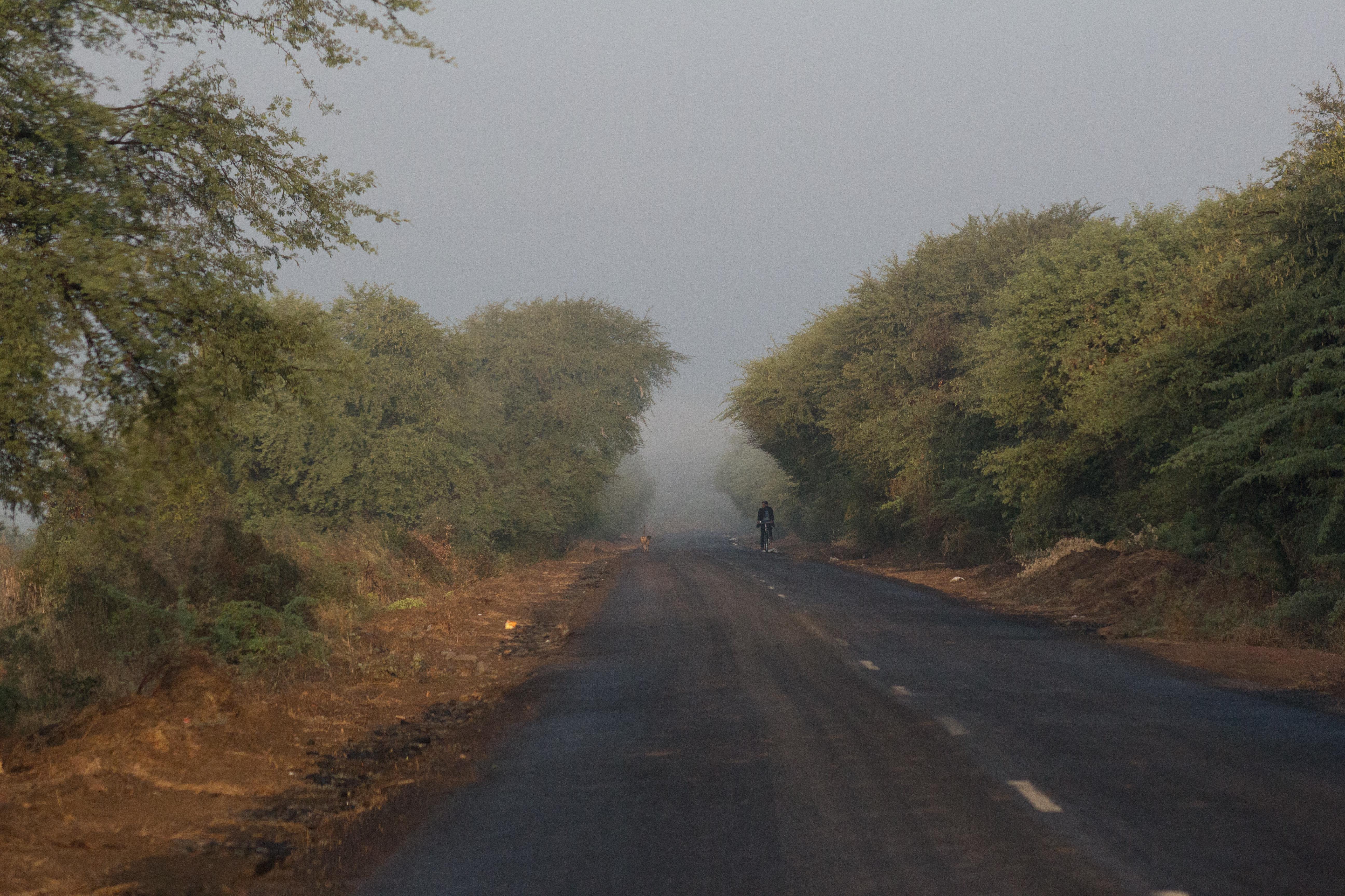
We woke up quite early in the morning. After the morning chores, we headed towards Kavi Kamboi. Who on earth will tell us the direction for this remote place in this early hour? We are without any guides. But we were never worried about our route, as Maps was with us.
While Maps was showing some route, we followed the same. And we came across this beautiful country side road. And look at what we saw.

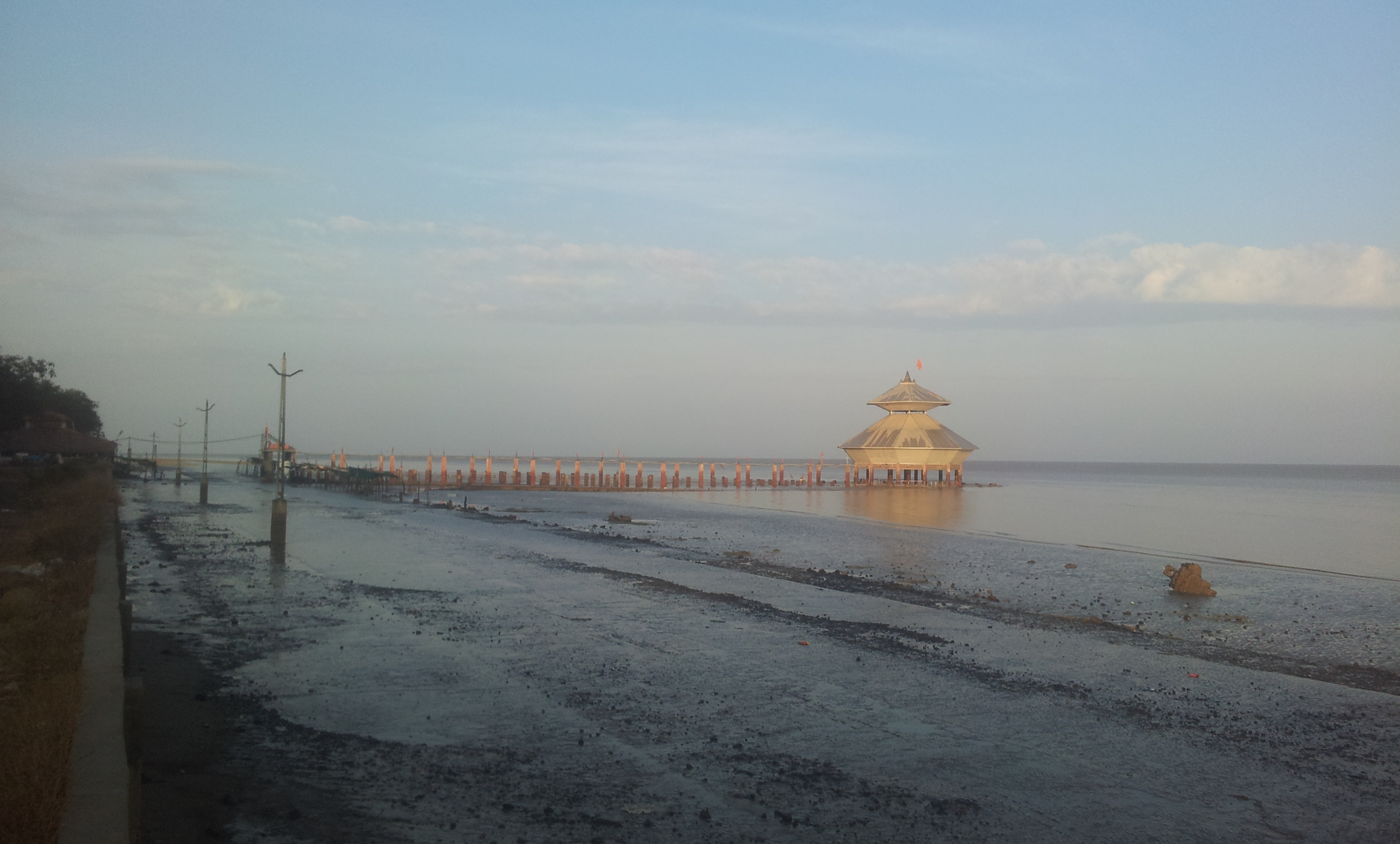
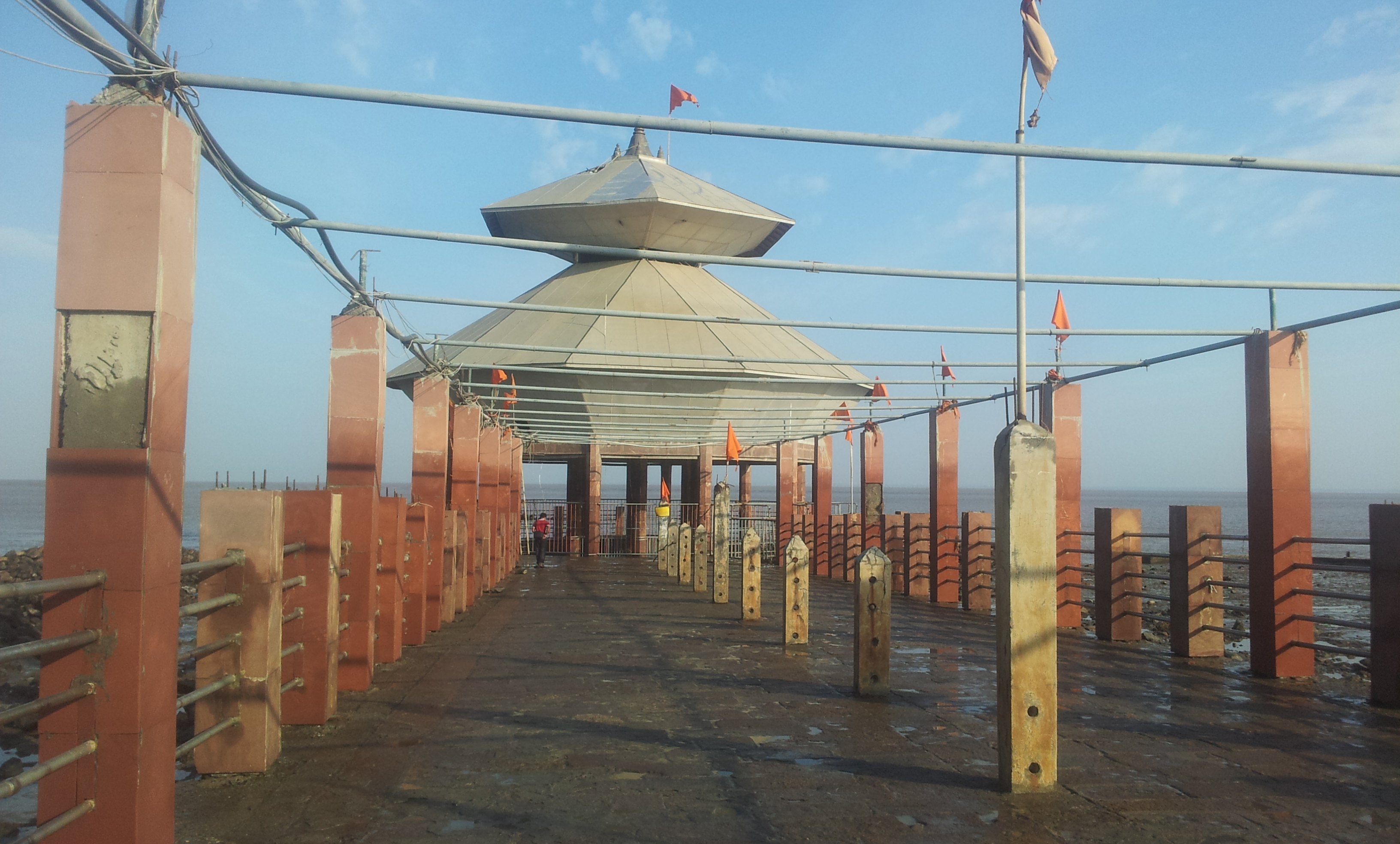
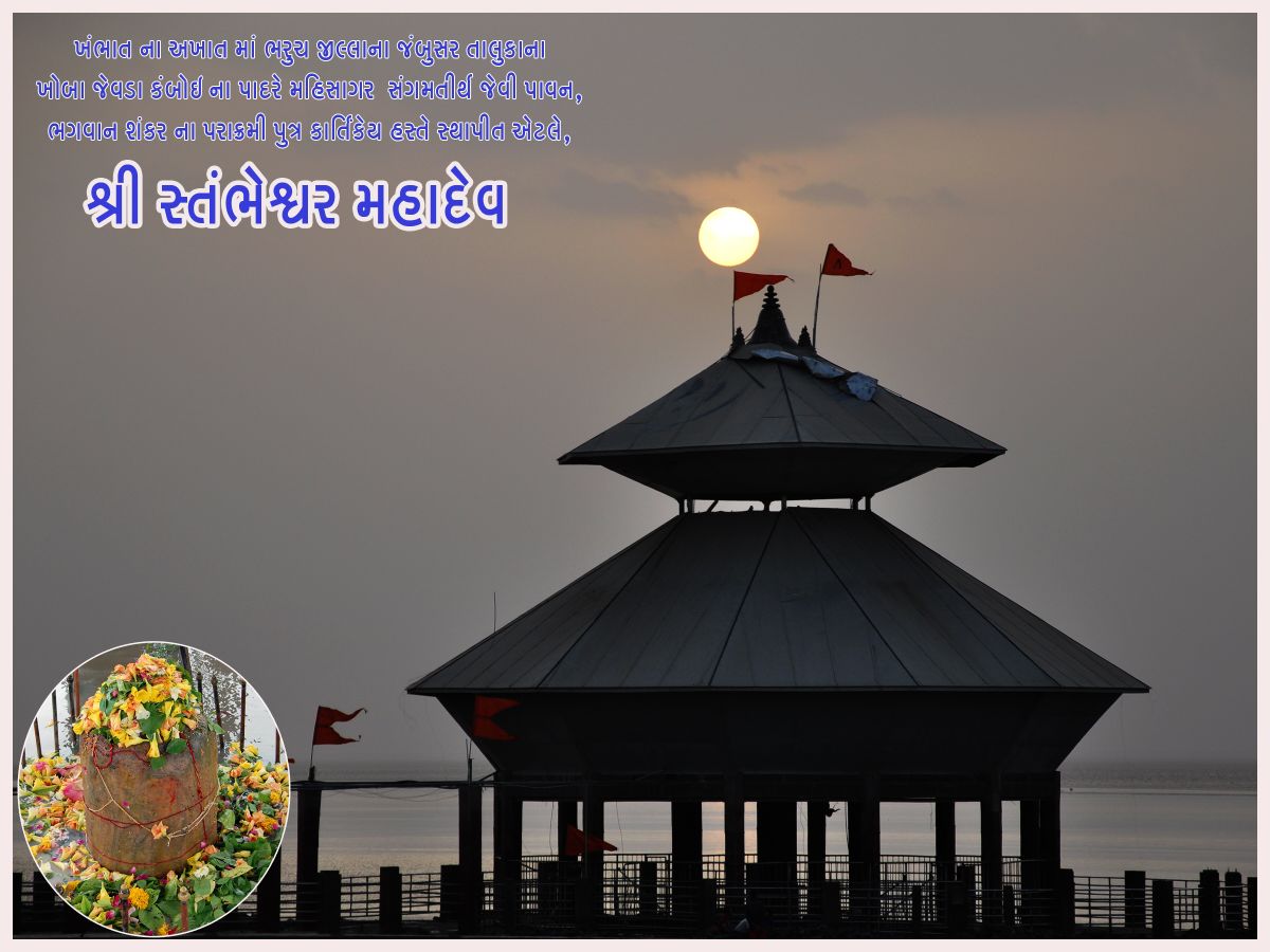
Shree Stambheshwar Mahadev, Kavi Kamboi
What shall I say about this temple? It is simple, an extremely simple Lord Shiva temple. It would not have appeared in our itinerary but for its uniqueness. I told you on Day 3, that the Gujarat coastline is something special from the rest of India’s coastline. Here lies the uniqueness of this temple.
So what is so special? Most of the Gujarat coastline is shallow near the beach. During high tides, the level of sea water raises by almost 10 to 15 feet. And during low tides it goes down by that 10 to 15 feet. It is more vibrant during “Purnima – full moon” and “Amavasya – no moon” days. So when the sea water retracts during low tides, the shoreline stretches forward (towards the sea) by few kilometers! Of course, all these vary from place to place in the Gujarat coastline.
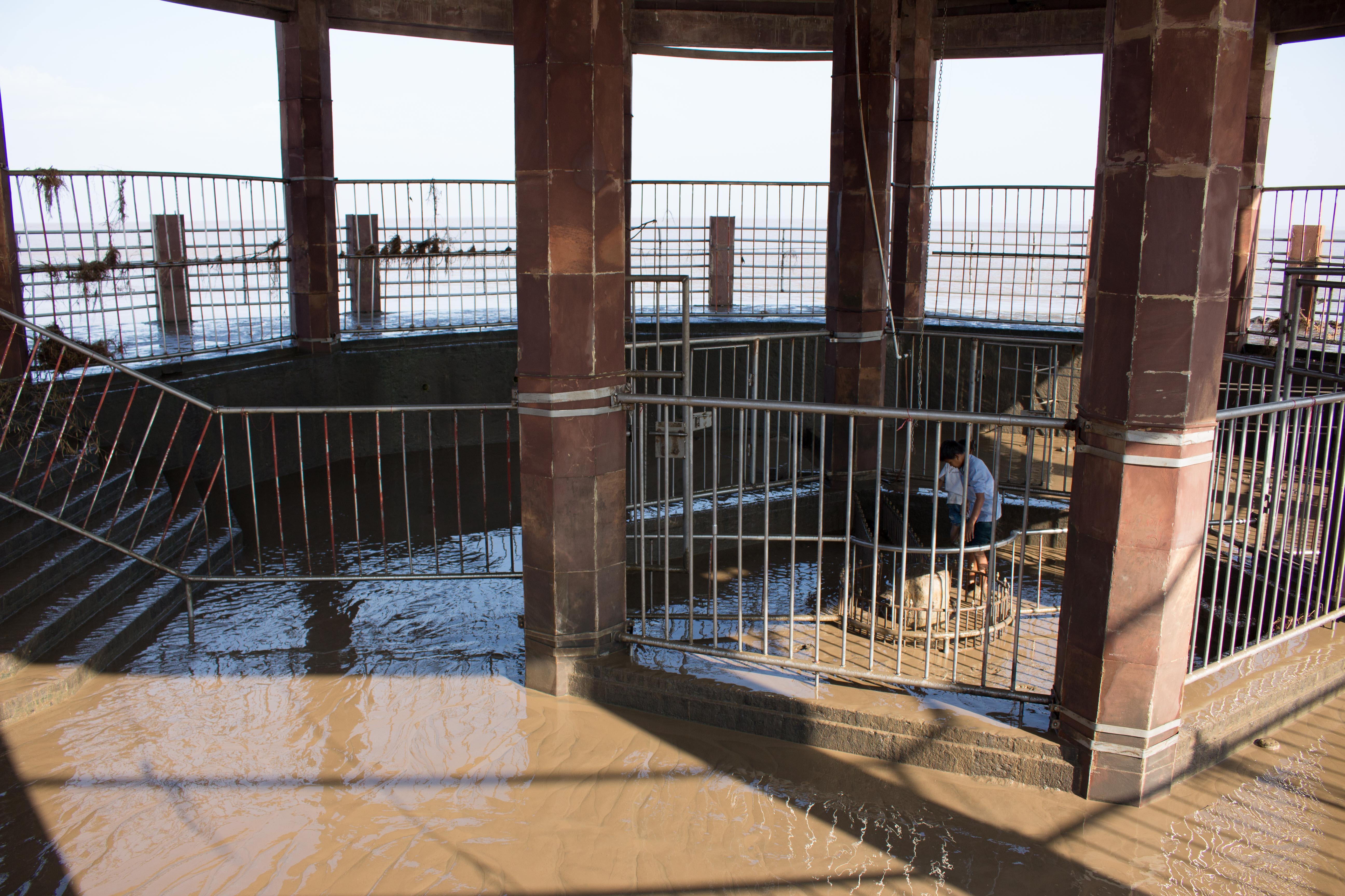
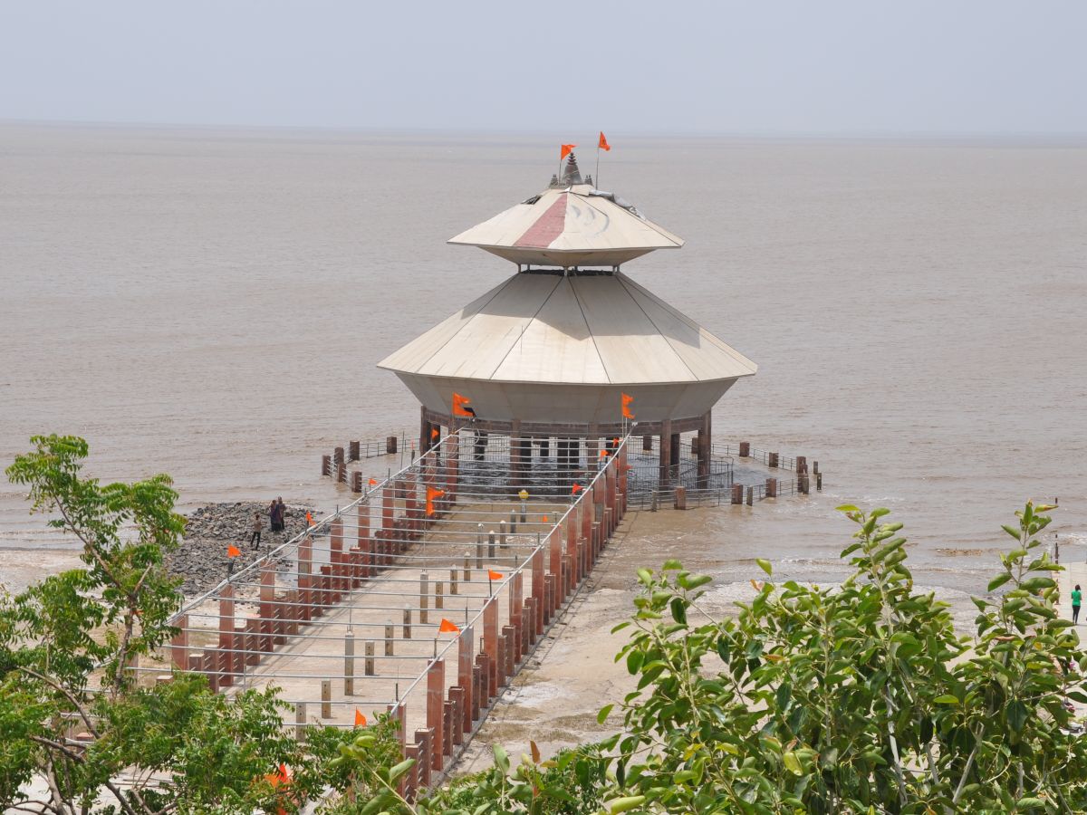
At Kavi Kamboi, during high tides, you see some pillars and roof of a building inside the sea water. (Because of these pillars, it is called as Stambheshwar). Then during low tides, the water slowly starts retracting. And the temple slowly starts emerging out of nowhere. And once the water has receded completely, you can go and visit the temple.
We reached the place around 8.00 am. Let us look at the photos and video one by one.
Let us watch a video shot now:
The temple is around 200 mts away from the shoreline. And there is a proper pathway up to the temple.
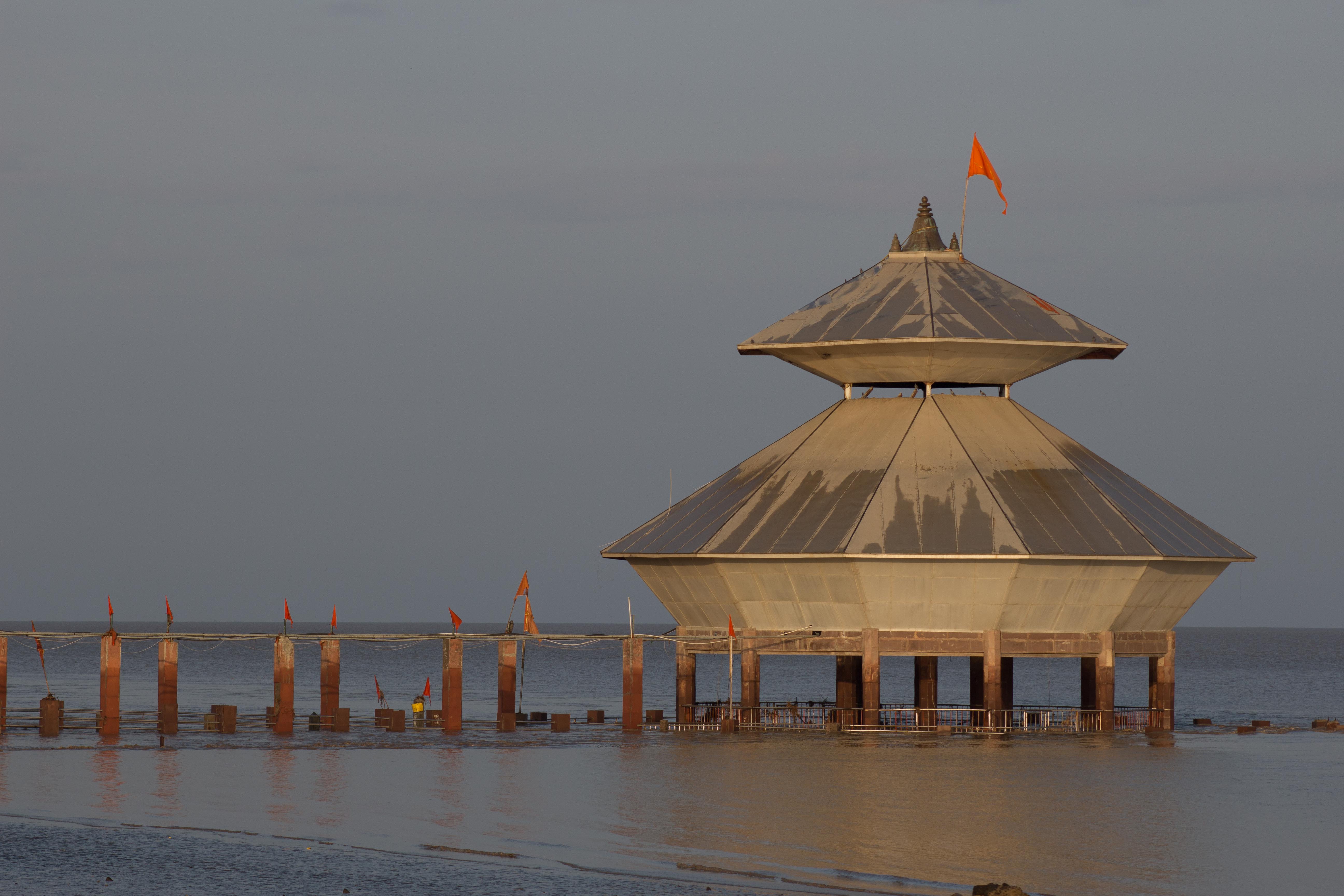
Now let us look at the photos taken at around 9.15am
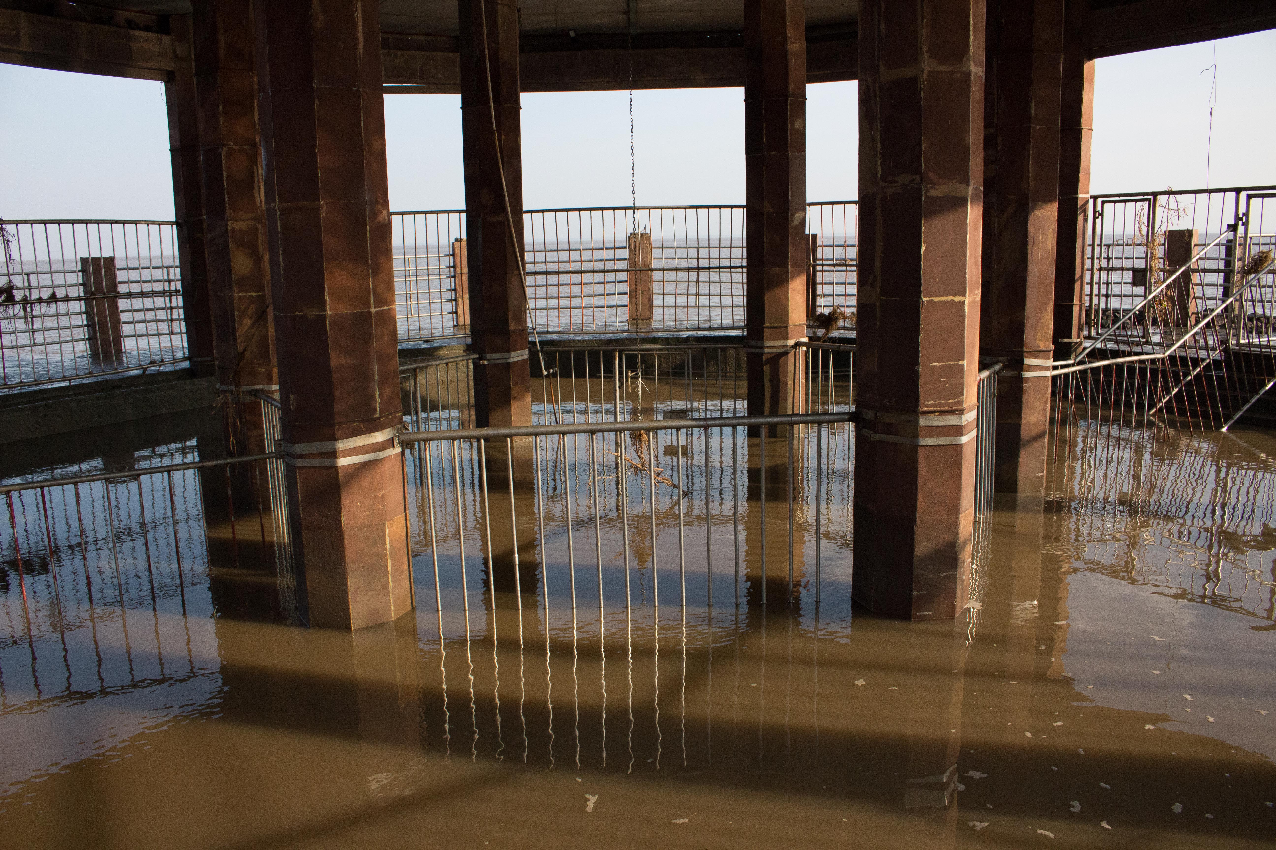
Let us watch another video taken at 09.15am.
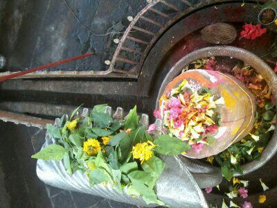
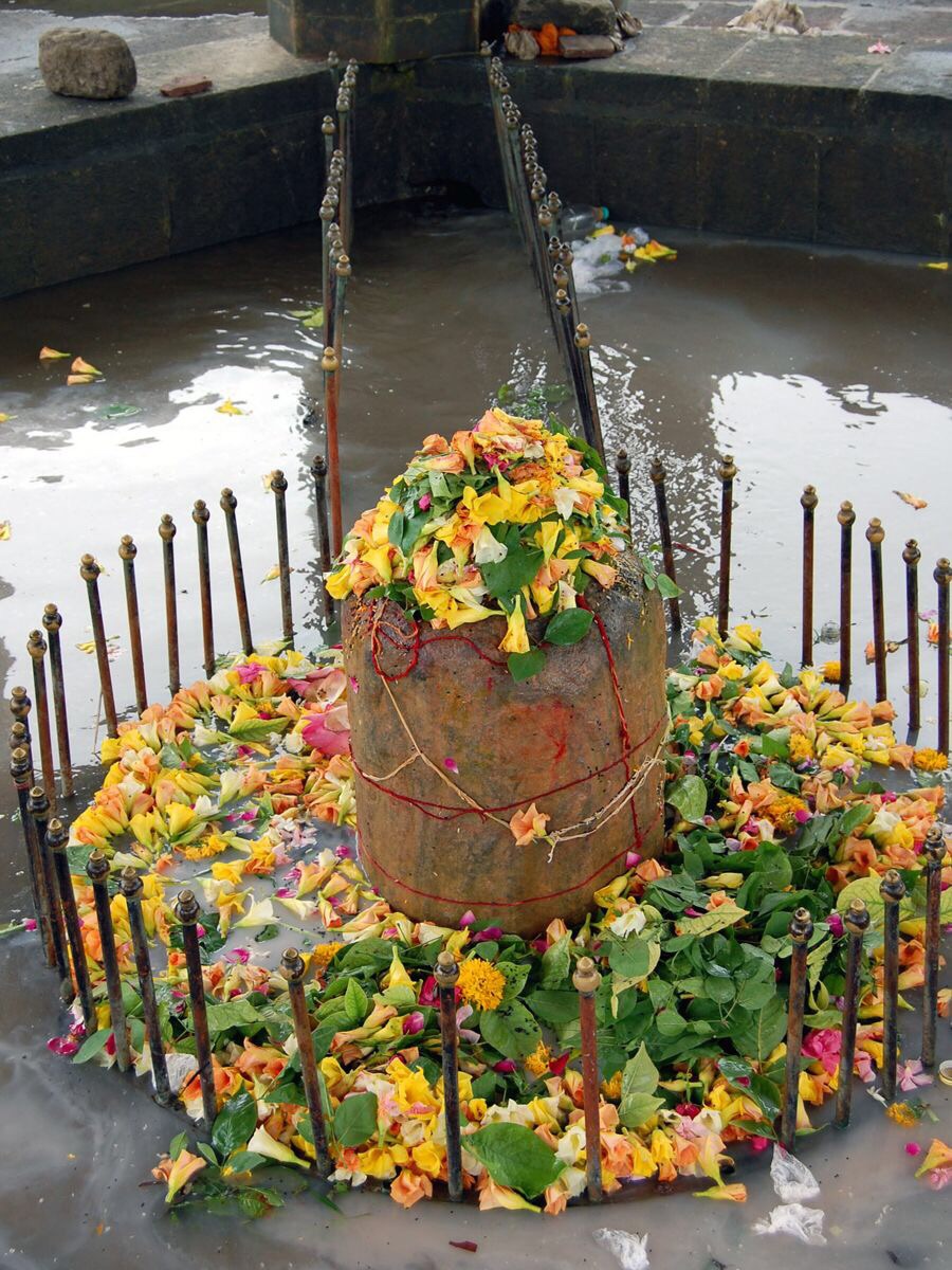
The sea water contains lots of mud. Once the water recedes completely, the nearby Ashram inmates clean the whole temple and it is ready for Darshan and pooja. You may just visit the temple for this uniqueness. And if you are a devotee, do the pooja also. The Shiva Lingam is around 1.5 to 2 feet in height.

Let us also watch a video shot at around 10.00 am.
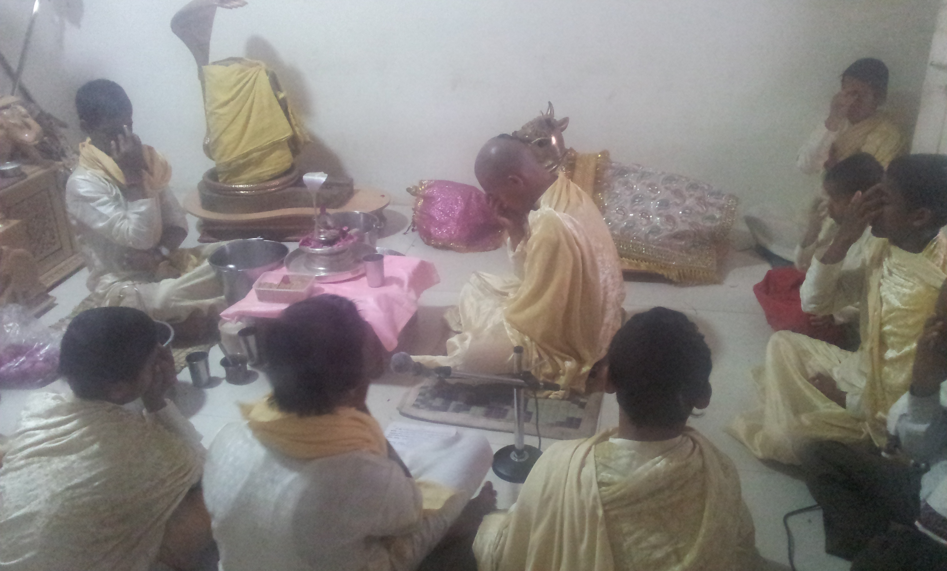
There is an Ashram close by, managed by a saint. Some orphan children from North East are studying Vedas and other holy rituals in the ashram. I think this temple is managed by the Ashram. And probably if you want to stay overnight, then the ashram will provide food and shelter. (I am not 100% sure, please reconfirm from the phone number given below).
For food and stay at the ashram at this temple site: 02644 230501; 9723622200; 9426878023
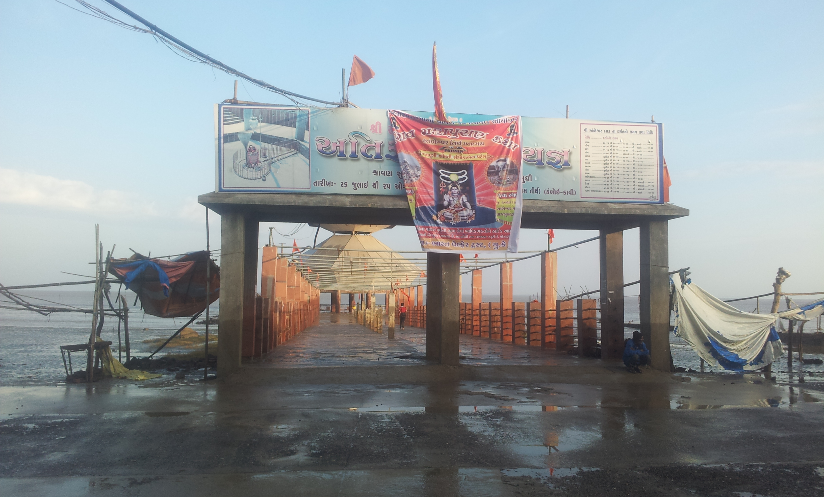
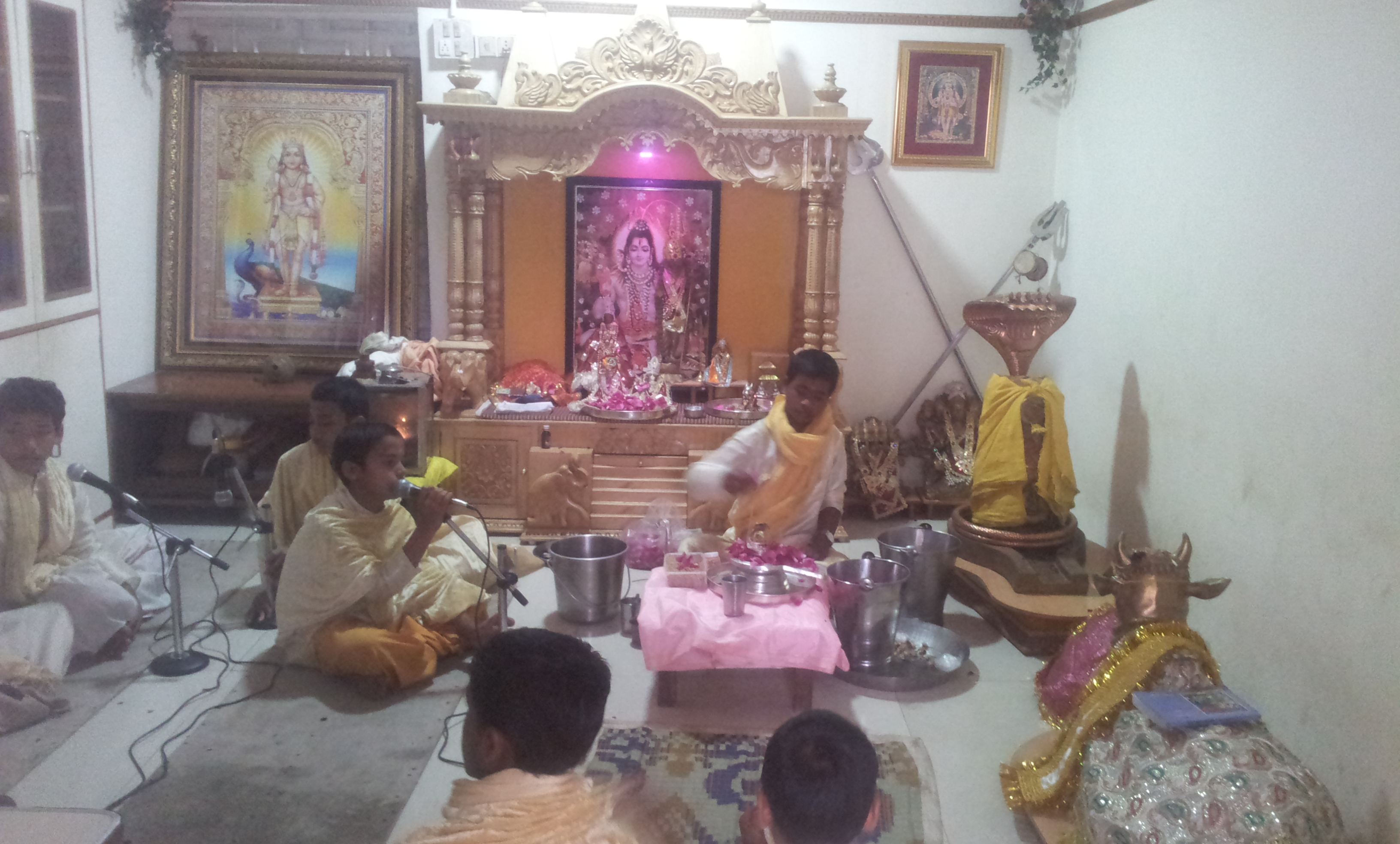
Let us look at what was going on in the Ashram when we arrived.

I know your next question. Is it safe, and what if the water level suddenly increases?
Don’t worry. Such things can happen only during tsunami!
Otherwise, the water level slowly starts rising and there will be plenty of time for you to come back. In fact there is a fixed time table for these low and high tides which depends on lunar calendar. So it is absolutely safe to visit the temple.
(After I returned back to Bengaluru from our Gujarat Tour, and after writing this part of the travelogue, I received some photos from the Swamiji of the Ashram; through WhatsApp. My sincere pranams to the Swamiji. And with his blessings I am uploading the photos for your viewing pleasure)
1. This photo might have been taken during late afternoon or so
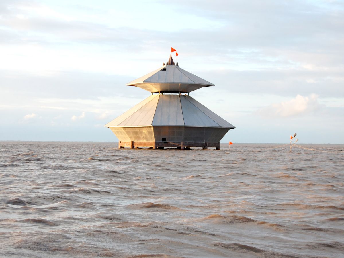
2. I think this could be the highest water level during high tides of Full Moon Day. And if I am right, the difference between this water level and during Low Tide water level could be as much as 20 feet ! That is the beauty of Gujarat Coast Line.
3. This photo might have been taken while the water level is going up or coming down.
4. Most probably this photo is taken from the roof above the Shiva Lingam

5. After the water has gone down, the temple will be cleaned. You can see the Lingam with full decoration, flowers, turmeric etc.
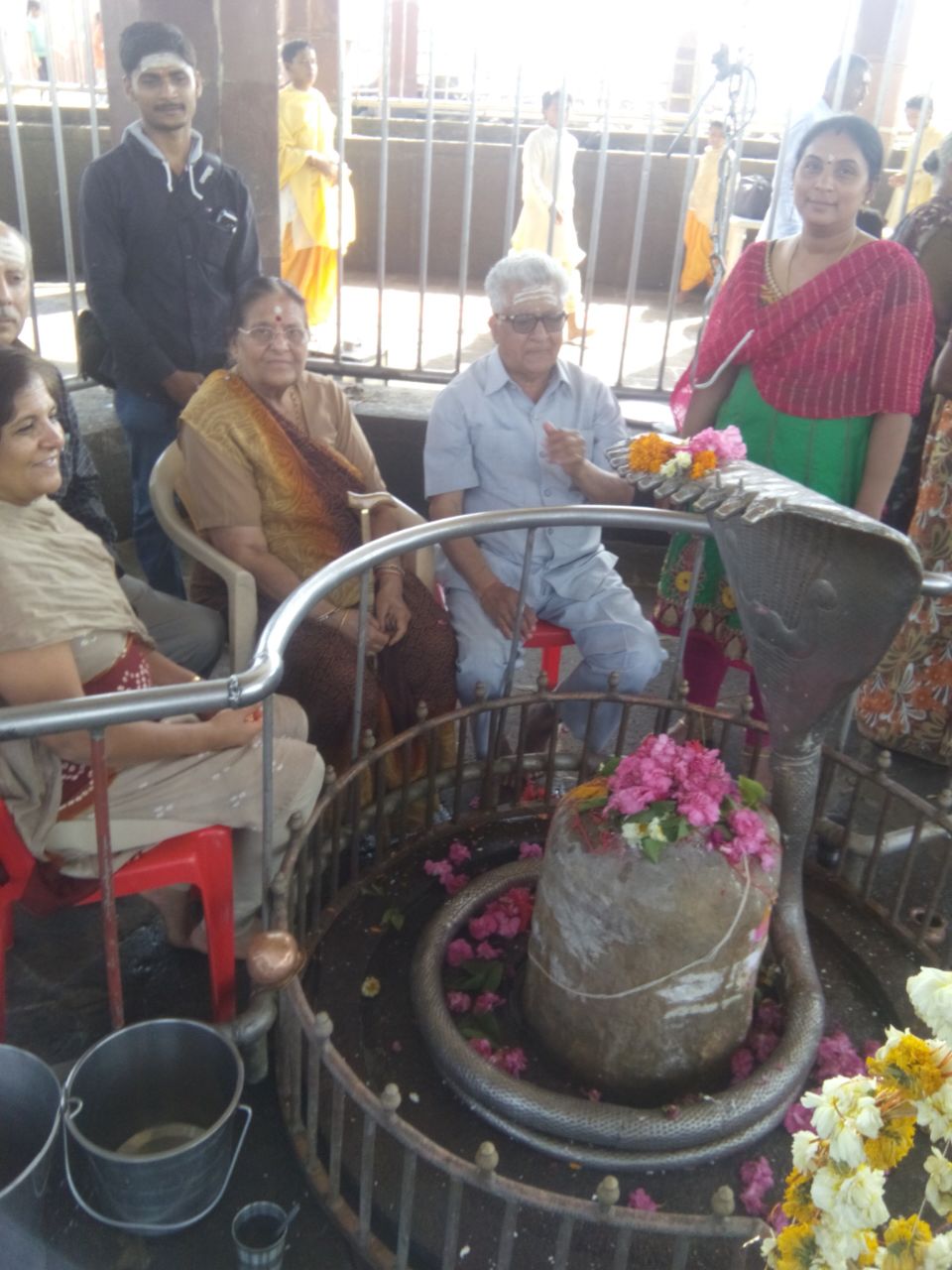
6. Looks like some devotees are performing some Pooja or rituals. All these items will be taken out to the Ashram once the water level starts increasing.

7. This is taken after the water level has started increasing. This is what remains when there is water.
8. Another photo, after the pooja is over and the water level is increasing.
Note: All the comments for the above photos are my imagination only. If anything is this is wrong, my apologies.
After visiting this temple, we went to Kayavarohan Temple.
Kayavarohan Temple
{Kayavarohan is known as Kashi (Varanasi) of Gujarat. It is one of the 68 ‘teerthas’ (Pilgrimage) of Lord Shiva as mentioned in the Shiva Purana. It is of great significance to the Pashupatas. For those in the spiritual following of Lakulish (28th birth of Shiva), it is considered to be the place of Shiva’s appearance on earth in that incarnation.
Kayavarohan harbors the Brahmeshwar Jyotirshivlang temple, claimed to have been founded by Maharishi Vishwamitra. It has been held that the incarnation of Shiva in Lakulish has merged with the linga in Shambavi Mudra. The Kayavarohan lingam represents the “formless” but a unique, exceptional iconic form of Shiva bearing the image of a meditating yogi, who holds parchments in one hand and citron (Matulinga) in the other.
Presently, there is an underground meditation cave at the Kayavarohana temple used for seclusion and meditation; source wikipedia/internet}.
What more shall I say other than the information given above? This is also a special temple. The black stone shiv lingam inside the sanctum sanctorum contains the statue of lord Shiva. And all the inside walls of the temple contains marble tiles, in which you can find various Yogasanas. I have not come across this kind of a temple anywhere in India.
Website: http://ktss.in/ Contact: 02663 271245


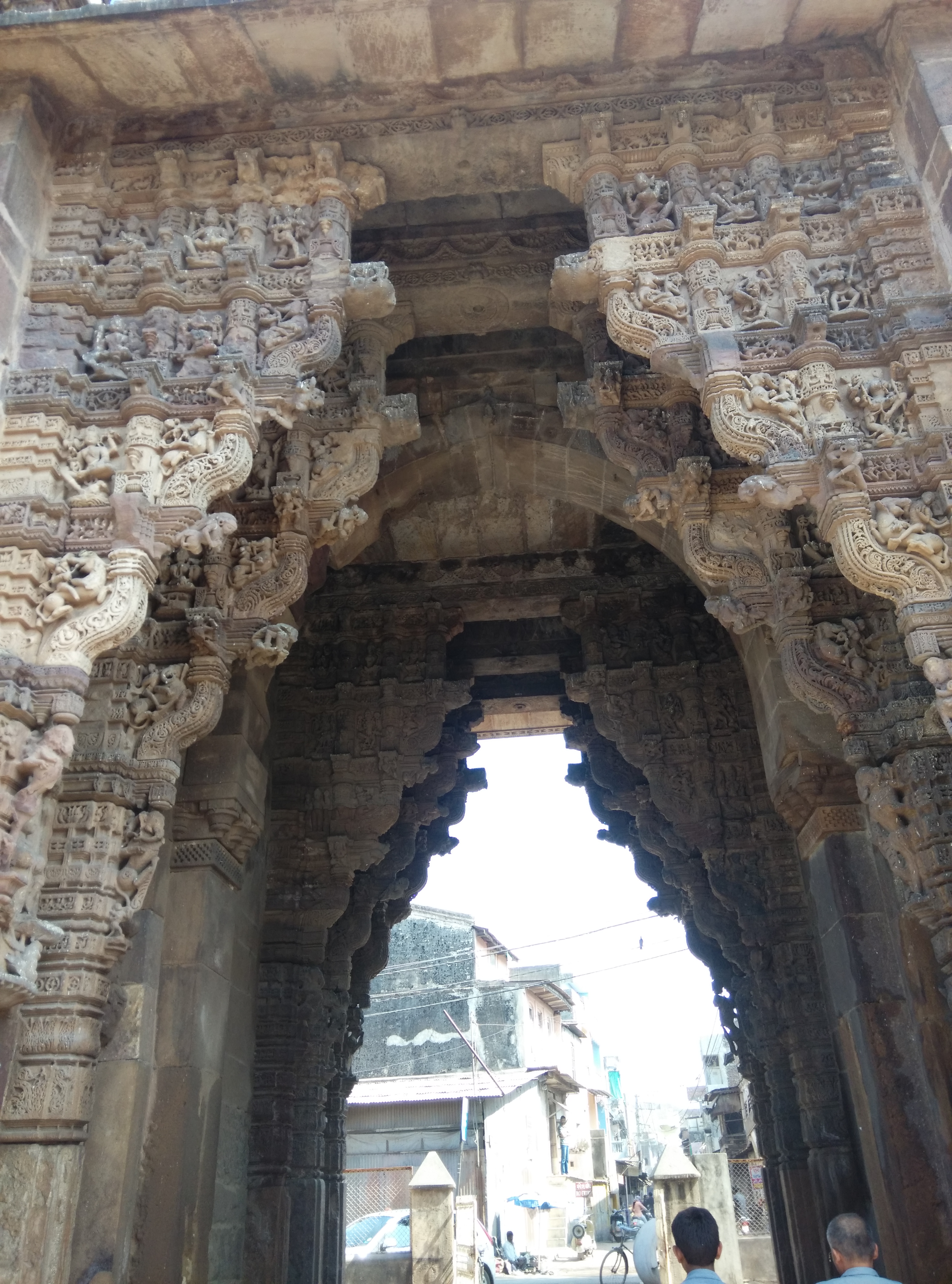
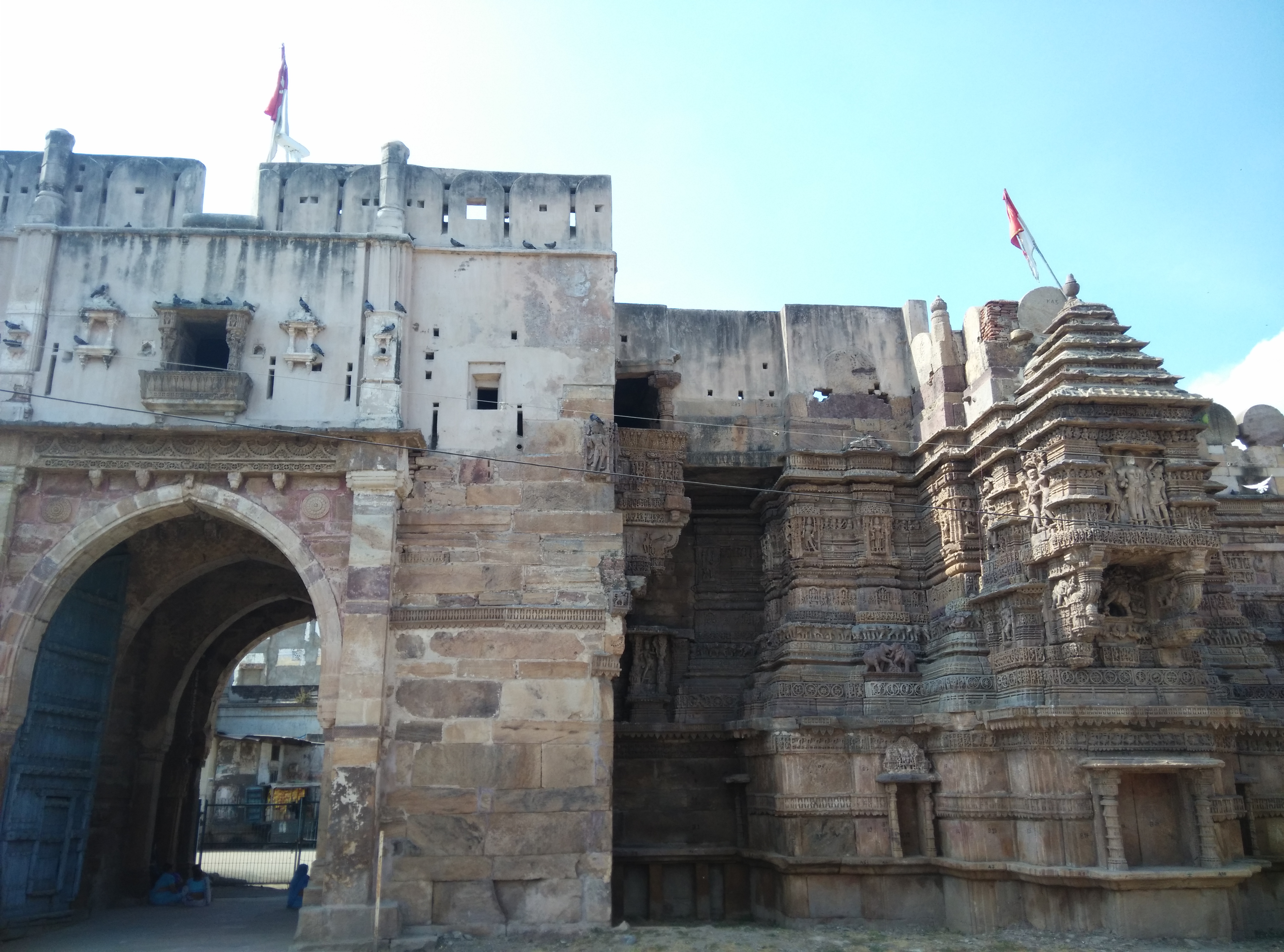
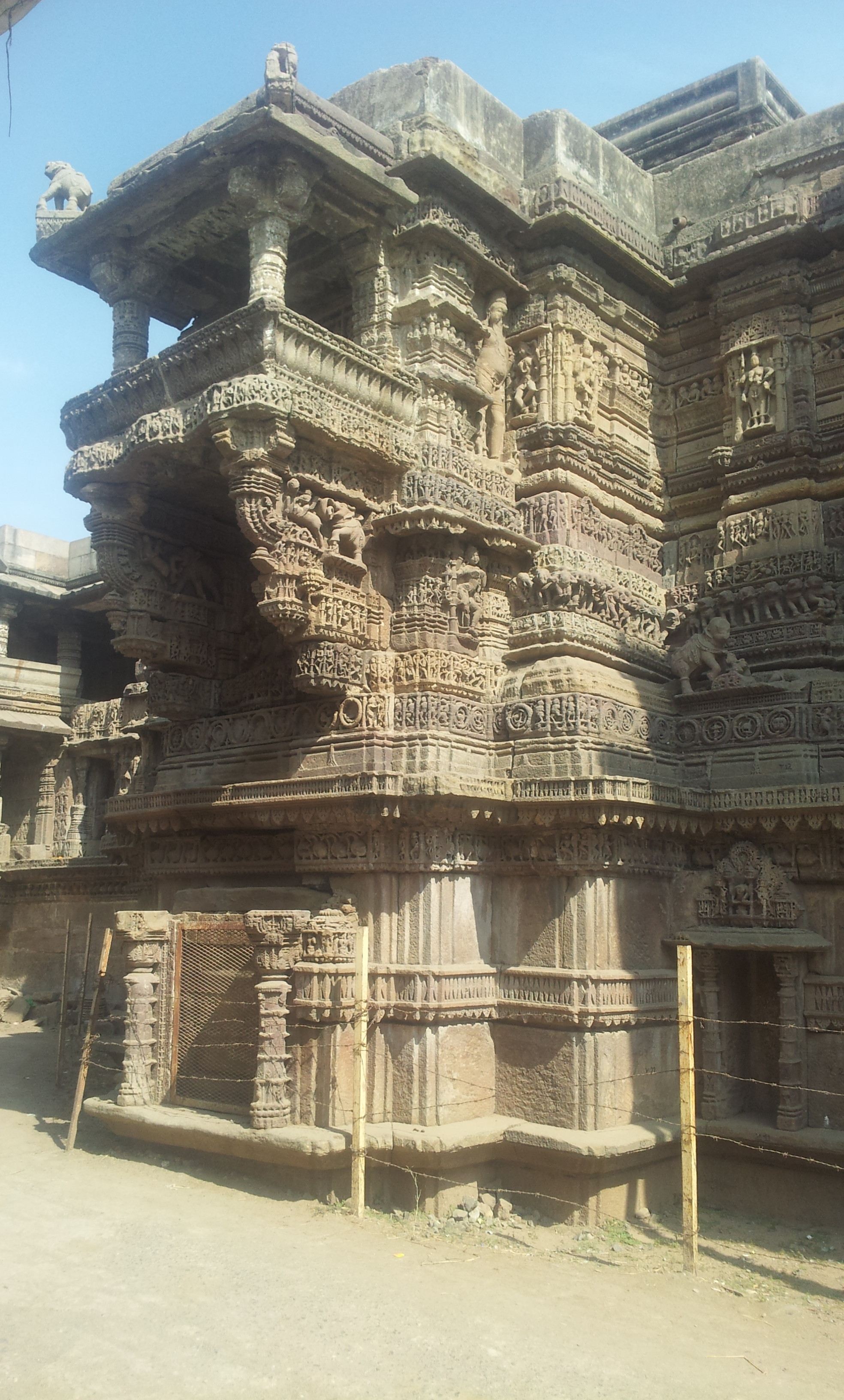
Dabhoi Fort
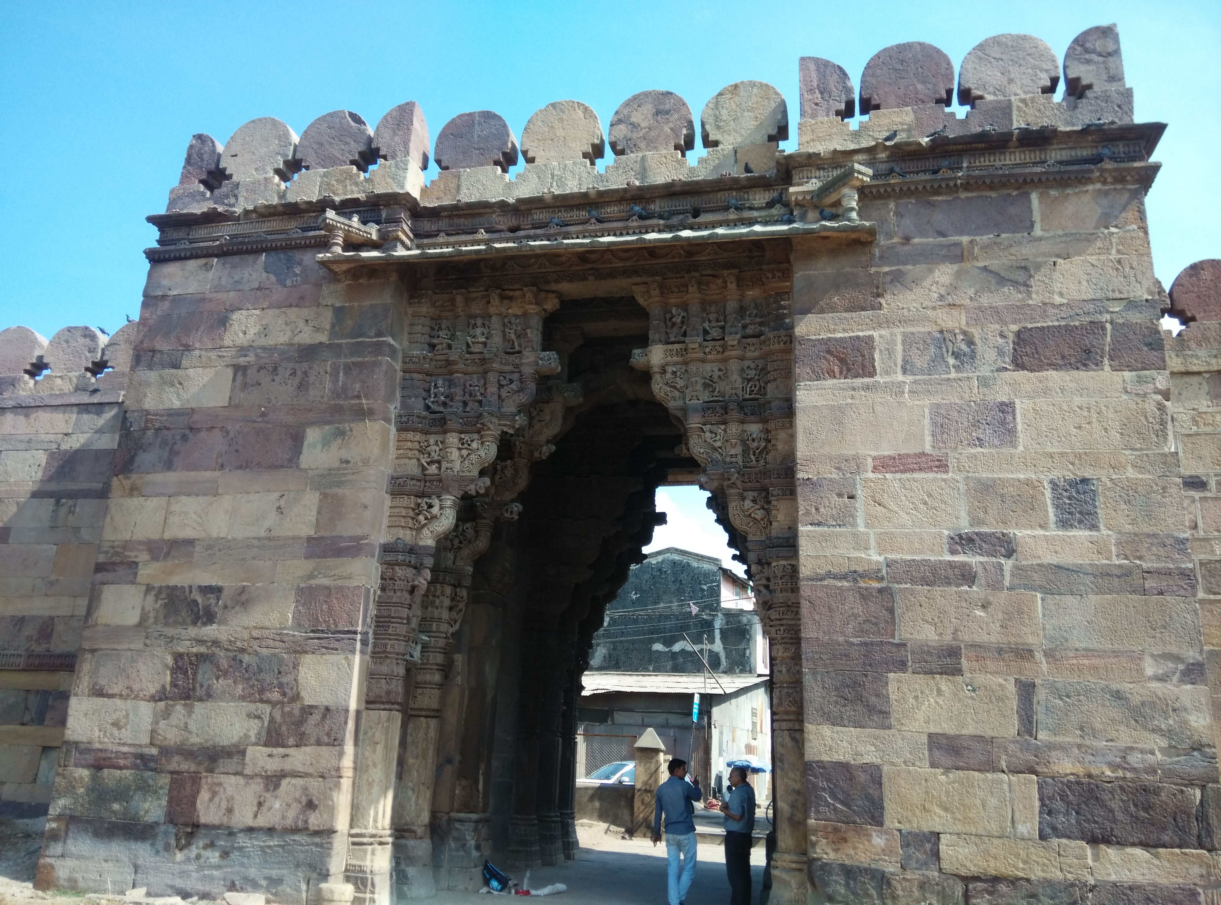
Our next destination was Dabhoi fort. Dabhoi is a major gateway for Narmada Dam. So it will be a big blunder if you skip this place and proceed straight towards the Narmada Dam.
{The Dabhoi fort is a rare surviving example of Hindu military architecture. It is based on the shastri traditions described in various Vaastu scriptures. The architectural style, the exquisite stone carving and iconography on the fort walls and gates are extremely beautiful. As per Jain inscriptions of Girnar, it is a major Jain pilgrimage place. Shri Lodhan Parshvanath temple is the main attraction.
Dabhoi was established in the early 6th century AD. Its foundation and fortification is ascribed to the great King of Gujarat, Siddhraj Jaisinh (1093-1143 AD), who made this his frontier fortress.
There are four gates in the town, one in each cardinal direction, having indirect entry, located in the middle of each side of the fort wall. It was altered during the time of Visaldev and the Muslim rule. Hira Bhagol (named after the architect, Hiradhar) is the most exquisitely carved gate and is in the east. Vadodara Gate is in the west, Champaner Gate in the north and Nandod Gate in the south; source: wikipedia/Internet}
As we took a right turn from the Narmada Dam road, we immediately noticed the Gate, which happened to be the western gate. There was an ASI person looking after whatever that remained. I have seen many forts in India, including the famous Devagiri Daulatabad Fort (This was never conquered in any war). For the first time, I was stunned by looking at the architecture of the Fort wall.
I was confused whether it is a fort wall or a Temple wall. Then the ASI person told us that the eastern gate is much more beautiful than this one. It is exactly on the opposite end, and is around 1 km from here. We manoeuvred our car to that place with great difficulty through narrow roads. And it was worth going there.
We were bit disappointed for two reasons – we did not had enough time to explore everything at Dabhoi; and there were no guides to explain everything.
You may find some more details here:
http://www.desigujju.com/gujarattourism/en/place/71/Dabhoi
We had our lunch nearby and proceeded towards Narmada Dam.
Narmada Dam
Before going to Narmada Dam (and other related places), I must tell you about the Dams in other states. I have seen many small, medium and big dams in many states. I have visited these dams as a private tourist. In most of the states, most of the dams are forbidden for private tourists like us. Forget about taking a photograph, even we are not allowed near the dam. We will be shooed away like dogs. (Chhattisgarh was an exception, as we toured that state with the help of the Tourism Board). In this age of GPS and Satellites, it is highly ridiculous to prevent visitors from seeing those magnificent dams.
Now come to Narmada Dam. It is a pleasant welcome from this tourist friendly state. You are not only welcome but are also allowed to visit almost all the places. There is an official guide to accompany you throughout. In fact this was our first meeting with some government officials in the tour so far. And we got a glimpse of what Gujarat is.
Hold on, I know your first question. I will come to that in a while.
As we were proceeding on the road to the Dam, at the beginning we came across a reception center. And there was huge place to park our vehicle. We went to the reception center. We gave our details, vehicle details and valid photo ID cards. After paying the prescribed fees, we were allotted an official guide (Mr. Aravind – 09429673645). And lol, we were allowed to visit almost all the places under the supervision of the guide. And except inside the generating station, we can take photo wherever we liked.
Yeah, now I am coming to your questions.
Where is Statue-Of-Unity (SOU) and how to go there?
Like “All roads leads to Rome”, from wherever you start, first you will reach the Reception Center. And after taking the permissions, the first important place that you will get on the way to Narmada Dam is the SOU location.
Where will it be constructed?
It will be constructed on a tiny rocky island called “Sadhu Bet” (Bet meaning Island).

But in the photo, it does not look like an Island?
Yes! It is more of an islet than an island. This islet is 3.2 km downstream of the Dam. This photo was taken on 22/01/2015 (winter). Hence there is not enough water around the islet.
Then how will this look after completion?
Further down the river, another small dam will be built to store water. So all this area will be filled with water. Then it will look like a Lake or a Reservoir.
What is the height, cost, completion date etc?
It will be tallest in the world! Height: 182 mts (597 feet). Cost: Rs 2,989 crore. Completion date: April 2018
Don’t you think it is a sheer waste of money?
In that case, my tour is also sheer waste of money. You are reading this travelogue by spending on internet charges, electricity, time etc. This is also sheer waste.
But…. still I am not convinced….?
The tourism industry will get a big boost from SOU. And the revenue from tourism will offset whatever that has been spent on this project.
Oh?
And it will be a pride of our mother land. We often say “I went to USA and saw Statue of Liberty”. Now people will say “I went to India and saw SOU”
Please continue…
Ok. You can read more about this in the following websites:
http://en.wikipedia.org/wiki/Statue_of_Unity
For more info contact: 079-23252338 / 23252356; OR 02640-232599 / 232533.
We proceeded further and came across the hydroelectric power plant (HEPP). It is an underground HEPP. After the mandatory checks, we were allowed to drive our own vehicle inside the tunnel up to the point where the generators are located. The guide was quite knowledgeable and explained the details of its functioning. As both of us are Engineers by qualification, it was very easy to know the knitty-gritty of the same.
(In Karnataka, it is seldom possible for a general visitor to go inside the power house. I have seen a couple of generating stations when I was a student. But I could not visit them along with my family, as getting permission is impossible)
From the power house, we went near the actual Dam. The heightening of the Dam work is in progress. So we were not allowed there. But we went to the Dam View Point, and took photos.


Before I give you some more details of this Dam project, let me tell you something else. In this tour, we have covered almost entire length and breadth of Gujarat. The drinking and irrigation water of Narmada River has been taken up to the westernmost point of India. Yes, i.e. up to Bhuj and beyond, almost up to Koteshwar temple. That is a whopping 700 kms.
(Narmada originates from Amarkantak, a village in MP bordering Chhattisgarh. And the distance between Amarkantak and Koteshwar is around 1750 km!)

One can’t imagine Gujarat without this project. It is the lifeline of Gujarat. It has benefited three more states also, but that is in the details below.
Some technical details of the Project for those who are interested:
Name: Sardar Sarovar Dam & Sardar Sarovar Project
Type: Large irrigation and hydroelectric multi-purpose dams on the Narmada River
Length: 1210 mts
Height: 535 feet from foundation is approved by Supreme Court. Present height is 260 feet.
States benefited: Gujarat, Madhya Pradesh, Maharashtra and Rajasthan.
Irrigation in Gujarat: Will irrigate around 18,450 sq km of land spread over 15 districts, 73 talukas, and 3,112 villages (75% of which is drought-prone areas of Kutch and Saurashtra)
Wild life sanctuaries benefited: Shoolpaneshewar WLS on left Bank, Nal Sarovar Bird Sanctuary in Ahmedabad, Black Buck National Park at Velavadar, Wild Ass Sanctuary in little Rann of Kachchh, Great Indian Bustard Sanctuary in Kachchh and Alia Bet at the mouth of River.
The dam will also provide flood protection to riverine reaches of Bharuch district.
Irrigation in Rajasthan: 730 sq km in the arid areas of Barmer and Jalore districts. (Entire place is drought prone)
Irrigation in Maharashtra: 37,500 ha. in the tribal hilly tract through lift irrigation.
Drinking Water: 9633 villages (53% of Gujarat) and 131 urban centers in Gujarat; 1336 villages & 3 towns in Rajasthan.
Canal Network: Approximately 75,000 km length within Gujarat


Hydro Power in the Dam: 6 x 200 MW plus 5 x 50 MW totaling 1450 MW.
Power sharing: Among MP, MH and Gujarat in the ratio of 57:27:16 respectively.
Solar power in the canal: By placing solar panels over the canal in Vadodara city, 10 MW is already functional (25 MW is proposed). It also helps to reduce the evaporation of water. And there is no question of Land Acquisition.
Honorable Supreme Court has made this observation:
“The argument in favour of the Sardar Sarovar Project is that the benefits are so large that they substantially outweigh the costs of the immediate human and environmental disruption. Without the dam, the long term costs for people would be much greater and lack of an income source for future generations would put increasing pressure on the environment. If the water of the Narmada River continues to flow to the sea unused, there appears to be no alternative to escalating human deprivation, particularly in the dry areas of Gujarat…..
…..The project has the potential to feed as many as 20 million people, provide domestic and industrial water for about 30 million, employ about 1 million, and provide valuable peak electric power in an area with high unmet power demand (farm pumps often get only a few hours of power per day). In addition, recent research shows substantial economic multiplier effects (investment and employment triggered by development) from irrigation development…..
…..Set against the future of about 70,000 project affected people, even without the multiplier effect, the ratio of beneficiaries to affected persons is well over 100:1” – Supreme Court Judgement
I think I have bored enough about Narmada. To sum it up, we covered all the visiting places in this Project and came back to the Reception Center.
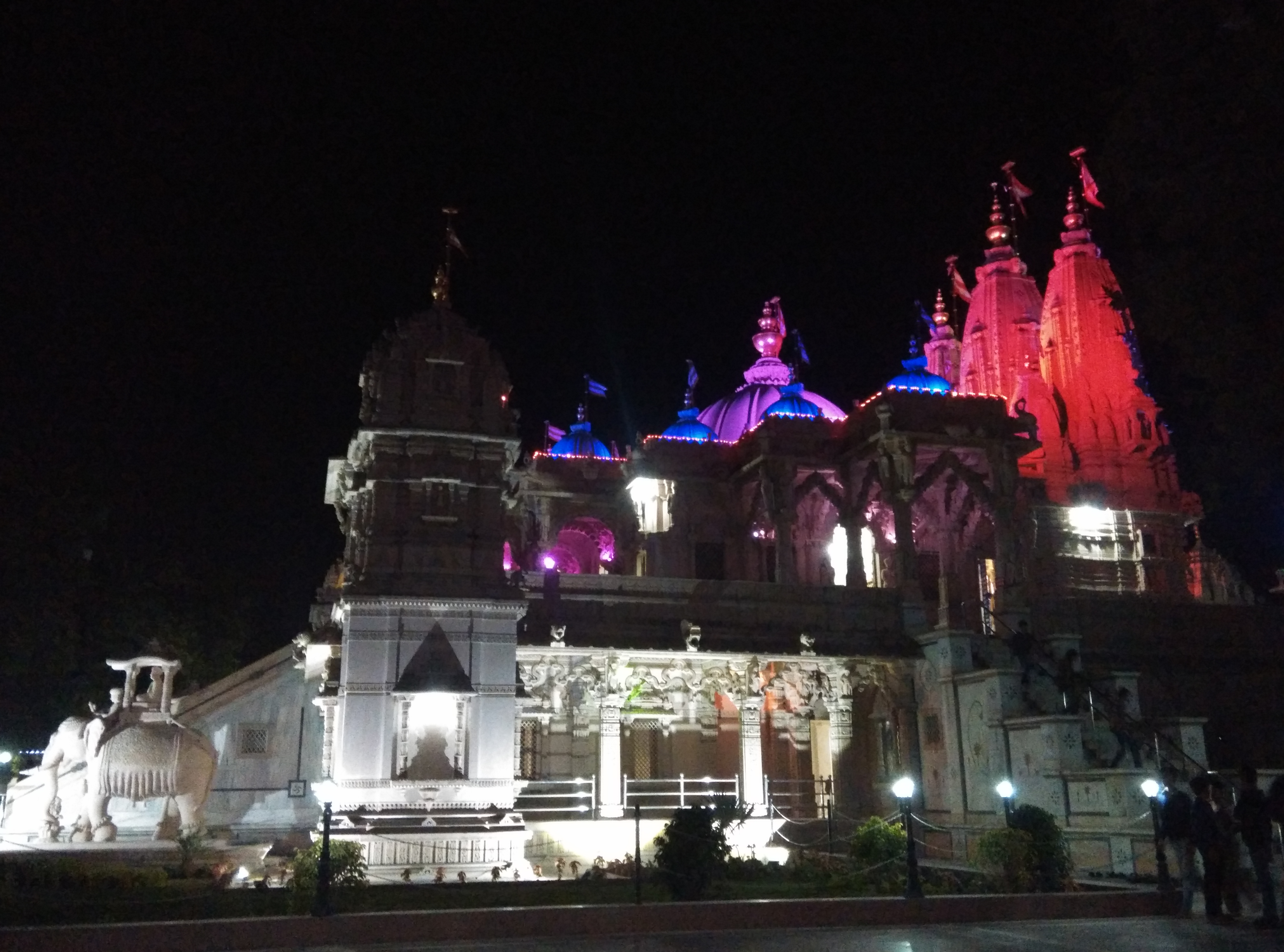
From there, we drove to Vadodara city. It was nearing 7 pm, and we drove to our usual place, BAPS Swami Narayan Mandir. And as usual, after the Darshan of the Mandir, we requested for a room, and settled down there.

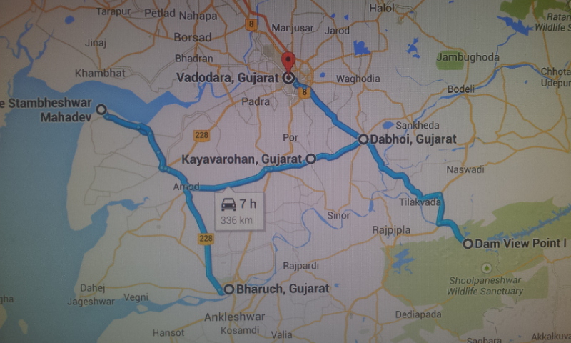
Total distance covered: 359 kms.
On Day 06 of my Gujarat tour, I visit Vadodara and explore the land of Amul India – Anand. Let me take you there
Read previous day’s account| Read next day’s account
Related Posts


About The Author
B P Bhat
An avid traveler, BP Bhat is among few travelers, who instead of scratching the surface of a destination, prefers to go deep and wide to understand, explore and soak in the beauty of a place. His quest for travel has taken him to all extremes of main land in the Mother India; from Leh to Kanyakumari and from Guhar Moti to Kibithu. He likes to explore all the important tourist places in India, State by State.