
Salasar Balaji Road Map from Delhi
Here is Salasar Balaji road map from Delhi and other nearby cities. Salasar is one of the most revered Balaji (lord Hanuman)temples in Rajasthan. Salasar Balaji is located in Churru district. Another immensely popular Balaji Temple in Rajasthan is Mehandipur Balaji Temple.
Salasar Balaji Road Map from Delhi
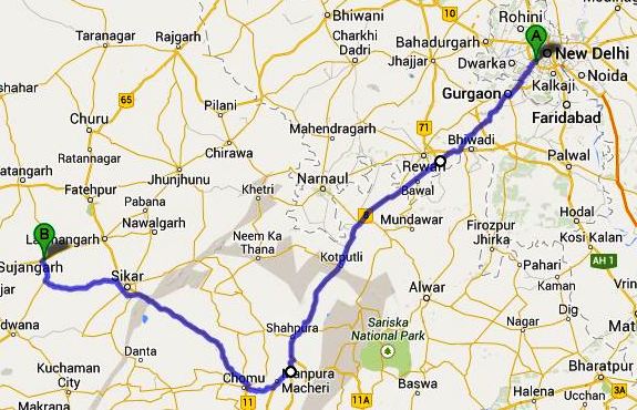
Salasar Balaji Road Map: Delhi – Gurgaon – Manesar – Dharuhera – Behror – Kotputli – Shahpura – Chandwaji – Chomu – Sikar – Salasar Balaji. (Approx. distance 370 km)
Salasar Balaji Road Map from Delhi via Rewari
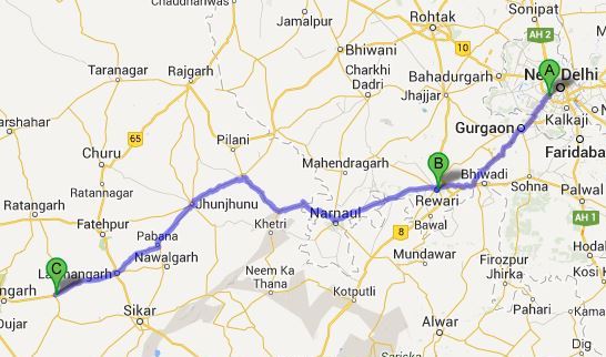
Salasar Balaji Road Map via Rewari: Delhi – Gurgaon – Manesar – Dharuhra – Rewari – Narnol – Singhana – Chidawa – Jhunjhunu – Mukandgarh – Laxmangarh – Salasar (Approx. distance 320 km)
Salasar Balaji Road Map from Jaipur
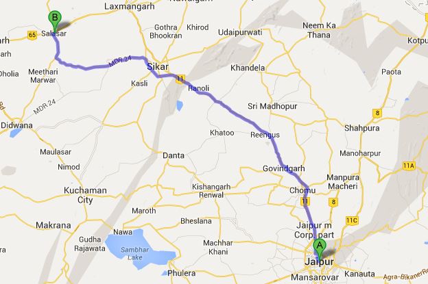
Salasar Balaji Route from Jaipur: Jaipur – Chomu – Govindgarh – Sikar – Laxmangarh – Salasar (Approx. distance 170 km)
How to reach Salasar Balaji?
A small town, Salasar comes under Sujangarh Panchayat Samiti and it is 24 km from Sujangarh. Salasar Balaji Temple is located on the Jodhpur – Ambala Highway (Highway No. 65). You can reach Salasar from Delhi, Jaipur, Bikaner and other neighbouring towns, which are well connected by regular bus service run by Rajasthan State Road Transport Corporation. Jaipur is the nearest airport to Salasar Balaji.
Nearest Railway Station to Salasar Balaji
Ratangarh is a popular railway station to Salasar Balaji. The distance between Salasar Balaji and Ratangarh is around 50 km. Other railway stations close to Salasar Balaji are Sujangarh (27 km), Lakshmangarh (30km) and sikar (54 km).

