
Gujarat Tour Diary: Day 14| Rann Utsav and on to Dholavira
(If you have come to this page while searching for some travel related information of Gujarat, I suggest you start from Day 0 of this travelogue.)
Today is the last day of our tour. We have to finish everything today itself. How to go ahead? Frankly speaking, I did not get proper sleep during the night. We woke up quite early. After the morning chores, we vacated the room at 5.45 am. There was no one to hand over the room key also.
We looked at the permit. ‘Vighakote, Bediya Bet (Hanuman Mandir) & Dhardo’ were mentioned in it (in some places in the internet, it is mentioned as Vighakot) . Again, we had no idea about what was ahead of India Bridge, except that it goes to the India – Pakistan border. While preparing my Tour Guide, I had searched for the travelogues for this topic but I could not get any details. So without knowing what is in store for us, we left Bhuj.
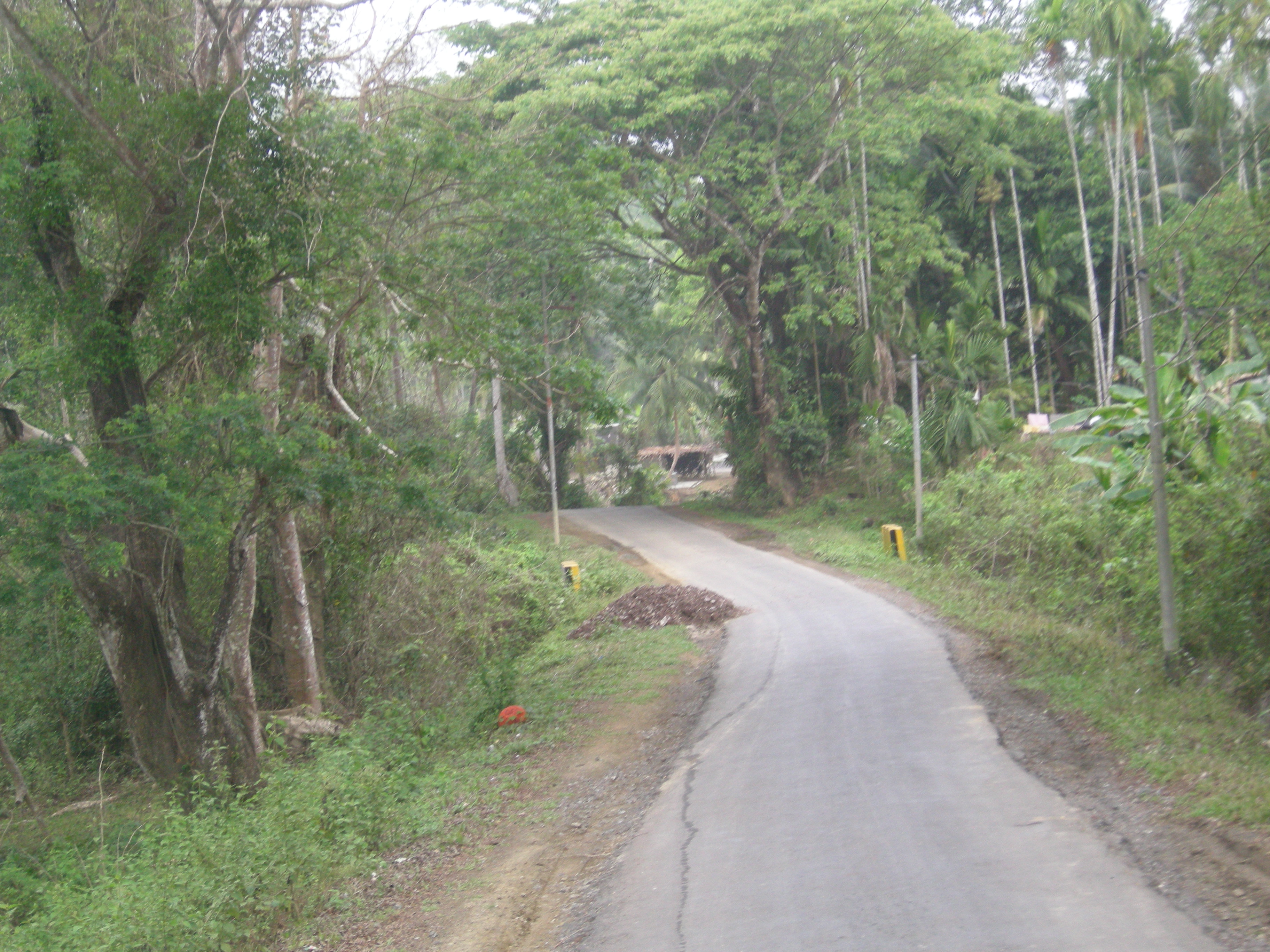
Whatever might be the time, whatever might be the place, Maps was with us as usual, to guide us. So as long as Maps was there, we had no fear about the route. We straightaway drove towards India Bridge. Today also we saw many Rabbits, Neelgais, Black buck, many variety of birds along the way. The biggest advantage of starting very early in the morning in any road near to the WLS is free sighting of wild animals.
India Bridge
By 7.20 am we were at India Bridge. The day was just going to start soon, with the arrival of the Sun God on the eastern side. The BSF sentry at the entry point of the bridge was little bit shocked to see our vehicle at this early hour. After we showed our permits, he let us in.
We went to the other end of the bridge. There was a check post. We parked our car and approached the BSF. They were also shocked for multiple reasons: travelers so early in the morning, and that too with a “KA01” car, and to top it all, self driven. They said “Sir, the entry timing is after 7.30 am, but we will allow you as you have come all the way from Bengaluru. Kindly deposit all your mobiles and cameras here it self.”
As said earlier, we had two mobiles and one camera. We kept all of them in one bag and deposited the same. Some biscuits and soft drinks are available with them, for sale. They asked for the photocopy of the permit, which we did not had. Then they told us that we must bring 3-4 photocopies of the permits to be given at each check posts along the route. As we were not aware of this, they told us to explain this point in each check post, and give back the original permit while returning.
War Memorial
India Bridge is 90 kms from Bhuj. After enquiring the details about the next journey, we went ahead. 12 kms from here is the War Memorial. This is in memory of soldiers who died during 1965 Indo-Pak war. To our horror, it was inaugurated just a couple of years back, by the then CM Modi. It took nearly 48 years to construct a memorial for our war heroes.
After visiting the Memorial, we went ahead for 3 kms, and came across the place called Chiriyamore, where a circle with Eagle statue is located. A left-turn here and another 60 kms will take us to Vighakote; whereas a right-turn here and 20 kms will take us to Bediya Bet (Hanuman Mandir). We had no idea about both the places. But as we have been visiting the temples all along, we decided to go to Vighakote first, and while returning, if time permits, go to the Mandir.
So we took the left turn. The road from here onwards was a single lane road. HT power line was running along the road. The whole place is completely barren, with white salt sandy deserts. Once a while we used to come across some Nelgais. We were the kings of the road, as no one would have started at this early morning. The road is not in excellent condition, and we were forced to slow down the car at many places. At 8.45 am we reached Vighakote, the final BSF checkpost.
Vighakote (Zero Point)
This place is also called as Zero Point. In fact there are several Zero Points along our border. As the name suggests, a Zero Point is where both the border country’s authority is Zero. Some times it is also called as ‘No Mans Land’.

So what is there at Vighakote? We approached the BSF office, where we were welcomed by an officer. He was also very curiously looking at “KA01” car. He took us to the view point, and explained all our questions in detail. In a nutshell:
“This border is different from the Wagah Border or for that matter, any other border. This is at Great Rann of Kutch (GRK), which is almost 75 kms width on both sides. It is seldom possible for any person to cross the border as there is no water, and they will be easily noticed. There is only one line of fencing from Indian Side. As no one from India want to cross over to Pak, they have not put fencing on their side. The fencing is electrified. There are BSF jawans, patrolling all the 24 hours. Every 2 kms along the border, there is a watch tower, which will be managed by 2 Jawans.”


(So how does the border look like, at Vighakote?. Hold on, I will show you the video a bit later)
We continued our discussion with the BSF officer.
Sir, what will you do if you want to have any type of meeting with them?
“We will raise our flag in this flag post. They will observe this. It might take few minutes to few days also. Once they notice the raised flag, they also will raise their flag. As we will be monitoring them, we will lower our flag immediately, indicating that we have observed it. Then one Jawan from each side will approach the fence and will exchange the information”
Why there is only BSF, and why there is no presence of any military here?
“After the 1965 Indo Pak war, there is absolutely peace here, as it is difficult to cross over. So only BSF, backed by military is present here.”
What are the facilities you get here. And what are your difficulties?
“We get all the food and other amenities. But we can’t communicate with our near and dear ones. There is a special phone here to connect to the outside world, which is very costly. And the only mode of entertainment is this dish TV, for which we have to pay from our pockets.”
Yes, life is very tough for these people. I have seen the border areas in Kashmir, Uttarakhand, West Bengal, Sikkim and Arunachal Pradesh. Every where it is same difficult story for these great 24×7 jawans. Why can’t our governments provide all the basic facilities to them, and keep them a bit happy?
As we were discussing so many issues with him, he also became friendly with us. And he offered a cup of special tea to us. We did not had anything since morning. It was very cold in this season of the year. So we relished our teas.
Thanking the officer, and with great satisfaction, we returned back to Chiriyamore. We had two options. One is to see the Hanuman Mandir, and second, to skip it and go straight. As the journey ahead is too long, we prayed for the blessings of Lord Hanuman from here itself. And we were back at the India Bridge at 11 am.
We collected our camera bag, returned the permit. With greatest satisfaction, we crossed the India Bridge. Before I continue our journey, I want you to take a half-an-hour break from my travelogue.
After I came back from our Gujarat tour, I saw a documentary film on Rann of Kutch in Rajya Sabha TV. And it is available in youtube also. You will get an idea of our border, the difficult life of BSF personnel, and the overall picture of this part of our motherland. Hence kindly spare some time to go through this wonderful video and resume my travel story.
After departing from BSF, we went to Black Hills or Kalo Dungar.
Black Hills and Dattatreya Temple
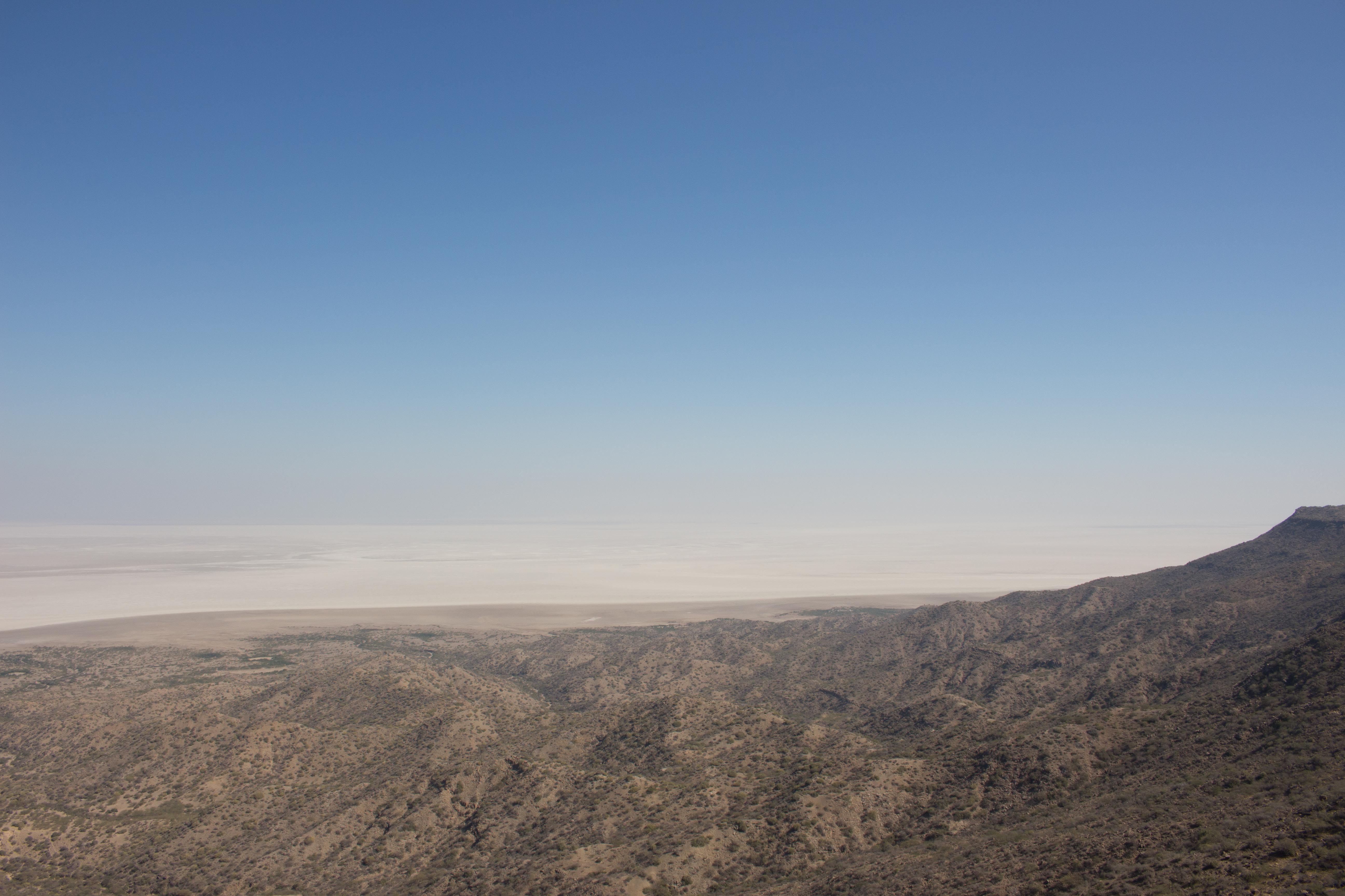
{Black Hills is the highest point in Kutch, at 462 m. From here, the entire northern horizon vanishes into the Great Rann, the desert and sky often becoming indistinguishable. Looking out from here, you can understand the tremendous effort that those who undertake the crossing of the Great Rann have to make. This is one of the places where a civilian can get closest to the Pak border. There is an Army post at the top; beyond here, only military personnel are allowed; source: wikipedia/internet}
Once we left the India Bridge, the remaining roads were quite decent. We had no difficulty in going up to the Dattatreya Temple. In the Rajyasabha video, they have mentioned about a Magnetic Hill in this Kalo Dungar. I was not aware of this when I toured this place. Also I did not notice any such board along the way. In case if you happen to notice the same, I request you to make a mention in the “comments” section at the end of this page. It will be helpful to other travelers.


We had the Darshan of the Lord and went to the nearby view point. We can see the India Bridge at a distant western side from the view point.

It is white, white and white every where. Only white salt desert. On the the east side the Black Hills stretches for a couple of kms, but beyond that is the white salt. This whole place is known as The Great Rann of Kutch.

We were very hungry, as we did not had anything since morning. We came back to the temple. The priest had finished the Pooja and had kept the Prasad in a raised platform, specially meant for the wild animals to come and eat. There were lots of tourists, with all types of cameras to shoot down the animals. While there was lot of excitement, the air was filled with the loud noise of the tourists. We Indians never learn to keep silence, even where it is most essential. How can some animal come if there is so much of loud noise?


We went to the dining hall and had Prasad Bhojan. The food was decent and filling. Thanking God, we left to our next destination.
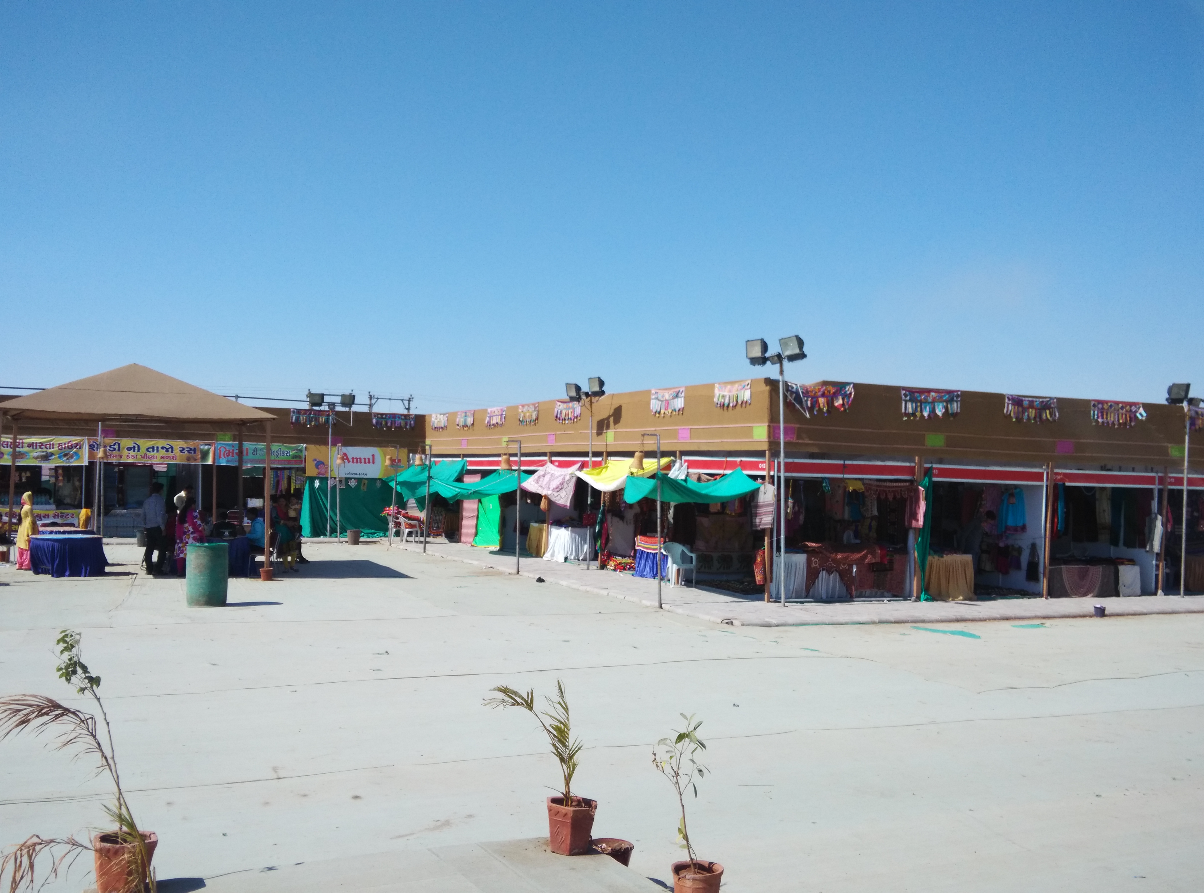
Kutch Desert Festival, Dhordo
{A visit to Kutch Desert Festival, at Dhordo, offers access to the interior and beautiful recesses of the region of Kutch. Kutch is a large inundated section of land bearing similarities with the American Wild West. Kutch can also be equated with a Desert in some terrains.
The Kutch Festival is celebrated from 01.12.2014 to 05.03.2015. During the celebration of Kutch Desert Festival, colorfully attired dancers, music concerts, Sindhi Bhajan performances, Langa Desert Music and shops selling embroideries and jewelry are the hallmarks}
There was the Festival Tent village. Lots of shops were also there selling various merchandises. As we hardly had any time, we skipped everything and went ahead.

This is called “The White Rann” for which the permit was given by GTDC. While visiting the border, we had seen the White Rann all along the way. Hence there was nothing special for us here. But for those who straightaway come here, this is a special, great & unique place.


Soon we left and drove (returned) towards Khavda
Khavda
{The town has excellent potters and leather craftsmen (indicating a heavy Muslim presence, as Hindus do not use leather), and ajrakh blockprinting at khatrivas. The KMVS office in Khavda sells embroidered handmade dolls and other textile products and is run by local women. Khavda is also the departure point to visit the world’s largest flamingo colony, at a lake in the desert out past Jamkundaliya, where a half million flamingos stop over on their migrations every year. The flamingo colony can only be reached by camel and is best visited in the winter}
We had no time to explore Khavda. This place is also famous for sweets, specially a dish called ‘Mawa’. We tasted it and it was good. But after tasting it, we came to know that it is not exclusive to Khavda. I have tasted this sweet in many places throughout India. In Karnataka it is called as “Belgavi Kunda”. More of it on my final day of this tour.
We were also supposed to go to Chari Dhand, but due to lack of time we skipped it.
Chari-Dhand Wetland Conservation Reserve
{The Chari-Dhand wetland conservation reserve is located on the edge of arid Banni grasslands and the marshy salt flats of the Rann of Kutch. Chari means salt affected and Dhand means shallow wetland. This is a seasonal desert wetland and only gets swampy during a good monsoon, receiving water from the north flowing rivers as well as from the huge catchment areas of many surrounding big hills. It is spread over an area of 80 sq km. It is home to nearly two lakh birds with migratory and endangered species of birds flocking into the area in thousands during monsoon and winters}
So from Khavda, we returned towards Bhuj. Around 17 kms before Bhuj, on the left side is the Rudra Mata Mandir.
Rudra Mata Mandir
{It is located at a scenic spot on the banks of the river Khari, the presiding deity of the Maharajas of Kutch – the Jadeja family. According to mythology, it is 400 years old. A stone’s throw away from the temple is the Garha Safari Lodge, a theme hotel that has a panoramic view of the river and offers an experience of staying in bhoongas, the traditional dwellings of the villagers but with all the modern comforts}

We thanked Maata for all the help so far, and prayed for her blessings to finish the rest of the tour. And we returned to Bhuj.
This finished the fourth tourist circuit of Kutch. The other important tourist circuit is Gandhidham, Kandla Port & Mandvi. As we were not much interested in these places, we had decided not to visit them. I had taken this decision while preparing my Tour Guide itself.
There is one more interesting place which is very near to Bhuj. And normally this is seen along with local sight seeing places of Bhuj.
Bhujodi
{A small town just 8 km southeast of Bhuj, Bhujodi is a major textile center of Kutch, with the vast majority of the 1200 inhabitants involved in textile handicraft production. Here you can meet weavers, tie-dye artists and block printers, most of who belong to the Vankar community. Many will let you watch them work; just ask around.}
We skipped this place also because of lack of time. The only major and important circuit left was the Dholavira circuit. So we decided to drive towards Dholavira. We had decided to go as far as possible towards Dholavira, and halt in the evening, wherever we can get some accommodation. We were also carrying Tents and sleeping bags in our car. So spending a night was not at all an issue for us. Thus with great satisfaction, we left Bhuj and drove towards Dholavira.
Towards Dholavira, the last tourist circuit in Kutch
We took the NH8A and NH15 and reached Chitrod. From here we took left turn towards SH51. We soon reached Rapar. It was around 5 pm, and we had a cup of tea here. Dholavira is another 90 odd kms from here. I must warn you here itself that, Rapar is the last place where we can get ‘anything’ or ‘something’ before reaching Dholavira. I mean the next 90 kms is through Great Rann of Kutch. There are no shops, no petrol bunks and NOTHING, except plain white salt till we reach Dholavira.
However Gujarat Tourism Development Corporation has provided good accommodation (plus food) at Dholavira. But again I warn you, except this accommodation, there are no petrol bunks or shops worth mentioning. (We are not very sure, whether even Rapar has got any Petrol Bunk). And most of the times, the mobile signals will also play hide-and-seek at Dholavira. So make sure to fill up your petrol tanks, buy any snacks and water bottles, and make the necessary phone calls. Once you are in Dholavira, you may have to depend on personal contacts only, as mobiles may not work.
We took off from Rapar and drove towards Dholavira. I must tell you four points here before I move on to Dholavira.
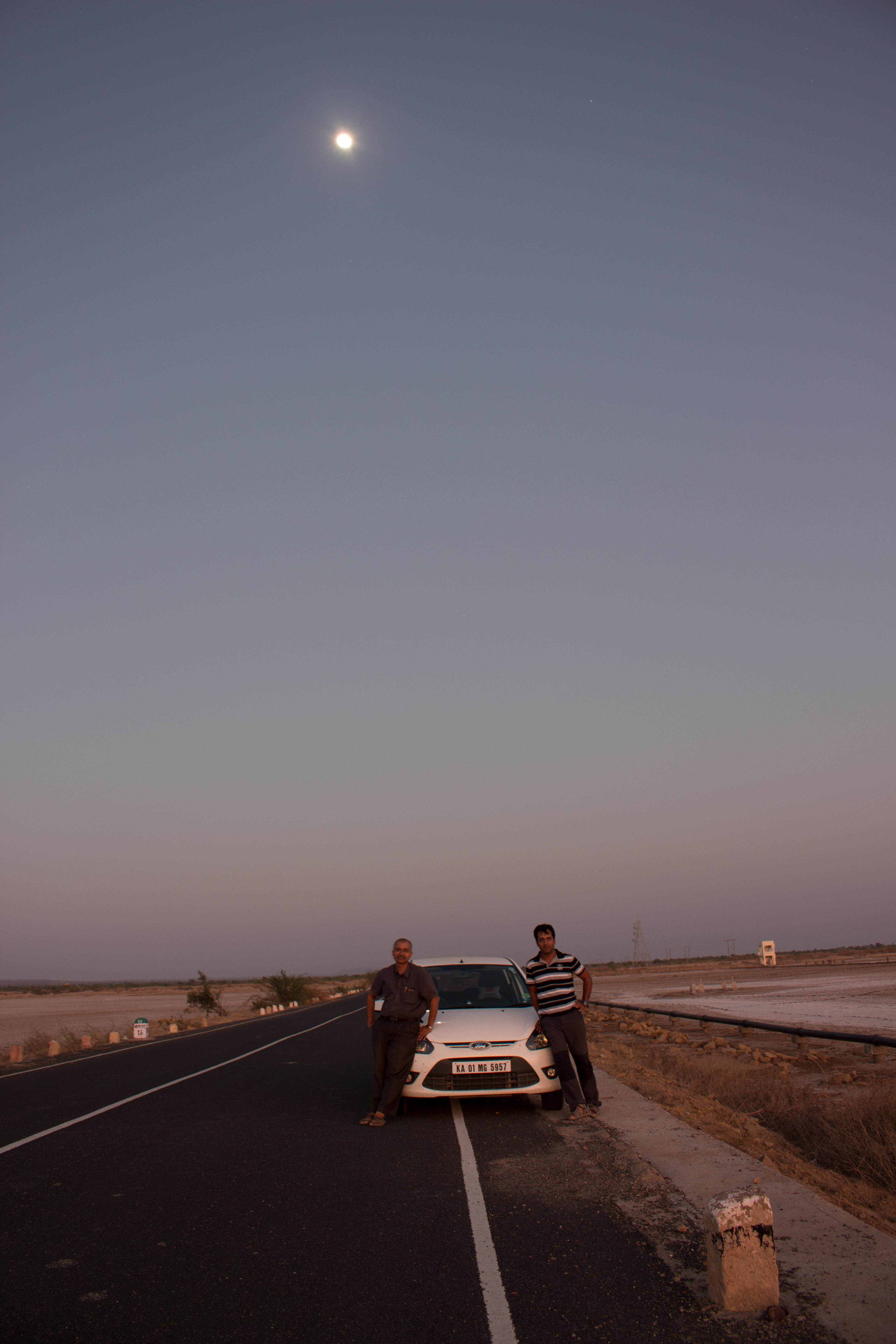
- Sunset at white desert: Look at Dholavira in Maps. It is in Khadir Island (Bet), surrounded by Rann of Kutch Lake. (This is part of Great Rann of Kutch – GRK). So, what is this Khadir Island and Lake? When we start going towards Dolavira, the GRK starts at 39 kms before Dholavira and ends at 31 kms before Dholavira. Which means for complete 8 kms, we get this GRK or White Desert. During rainy season, this GRK will become a White Lake, as the salt melts in the rain water. Thus the Khadir becomes an island.And while we are going here during Jan-Feb, all the water is dried up, making it a White Desert. And we see only white salt every where. Except the black SH51 tarred road on both the sides, it is white & white all the way. This is an ideal spot to take the Sunrise and Sunset photos, in case if you happen to be here during this time of the day. We were late by few minutes and we missed the golden opportunity to take Sunset photos. Hope you will remember this when you visit this place next time.


2. Dead-end roads: While preparing the Tour Guide, I have read about the details of each place few times. So I knew that Dholavira is a dead-end-point of the road. There are few such dead-end-points that I have visited during my various tours across India. To name a few- Tirunelveli to Kanyakumari in Tamilnadu, Rameshwaram to Dhanushkodi in Tamilnadu, Hayuliang to Kibithoo in Arunachal Pradesh, Digboi to Deban via Miao in Arunachal Pradesh, Leh to Pangong Lake in J&K, Gangtok to Nathu La in Sikkim, Gangtok to Yumesamdong via Valley of Flowers in Sikkim, Port Blair to Baratang Island in Andaman etc. Out of this, the road from Tirunelveli to Kanyakumari is via NH 7, ie. Vajpayee Road. Rest of the roads are managed by either State Govts or BRO. Look at some of these dead-end roads.


And you have already seen the dead-end road to Dholavira. So when we were going towards Dholavira, my road journeys in all these roads were coming to my mind as a flash back.
The stories of all the above places are today’s stories, where as Dholavira’s is nearly 5000 years old story. And Dholavira is not all that fit for present day human habitation. And what Modiji has done? And how is the road to a 5000 year old place?
Here Modi stands apart from rest of the current day leaders. No, I am not talking of politics. I know that politics (and religion) divides people. I am not here to divide you from me.
I am only talking of Gujarat roads, the Tourism Department and the way it is far ahead of other states in Tourism sector. To bring Amitab Bachchan as a brand ambassador, to make an excellent road and other infrastructure to this end-of-the-world place, and to a sell it as a tourist destination- it requires a visionary. And Modi scores one hundred percent marks in it.
Many countries in this world are existing mainly because of the revenue from tourism sector. Every state in our mother land has no dearth of great tourist places. Unfortunately most of them are lacking in maintenance, exposure, facilities etc. So why can’t we build such types of roads & infrastructure everywhere. I know that some of these places are near the border, or in partially prohibited areas etc. But the Govt must build world class infrastructure, and open a place for tourism. This will give enormous job to millions of local people. My intention of posting these photos is only this. And don’t take it in any other way.
3. Narmada river water: I had already told you about Narmada dam and the river water. We saw it at Little Rann of Kutch. Even at GRK, the Narmada water is flowing through pipe lines. Oh, what a great development. Rest of the states are failing to provide basic drinking water to even human beings, where as here we are witnessing the water being taken to the desert and a small village. That is why the Supreme Court has made that observation. {The argument in favour of the Sardar Sarovar Project is that the benefits are so large that they substantially outweigh the costs of the immediate human and environmental disruption …… Set against the future of about 70,000 project affected people, even without the multiplier effect, the ratio of beneficiaries to affected persons is well over 100:1}

4. Toran Tourist Complex
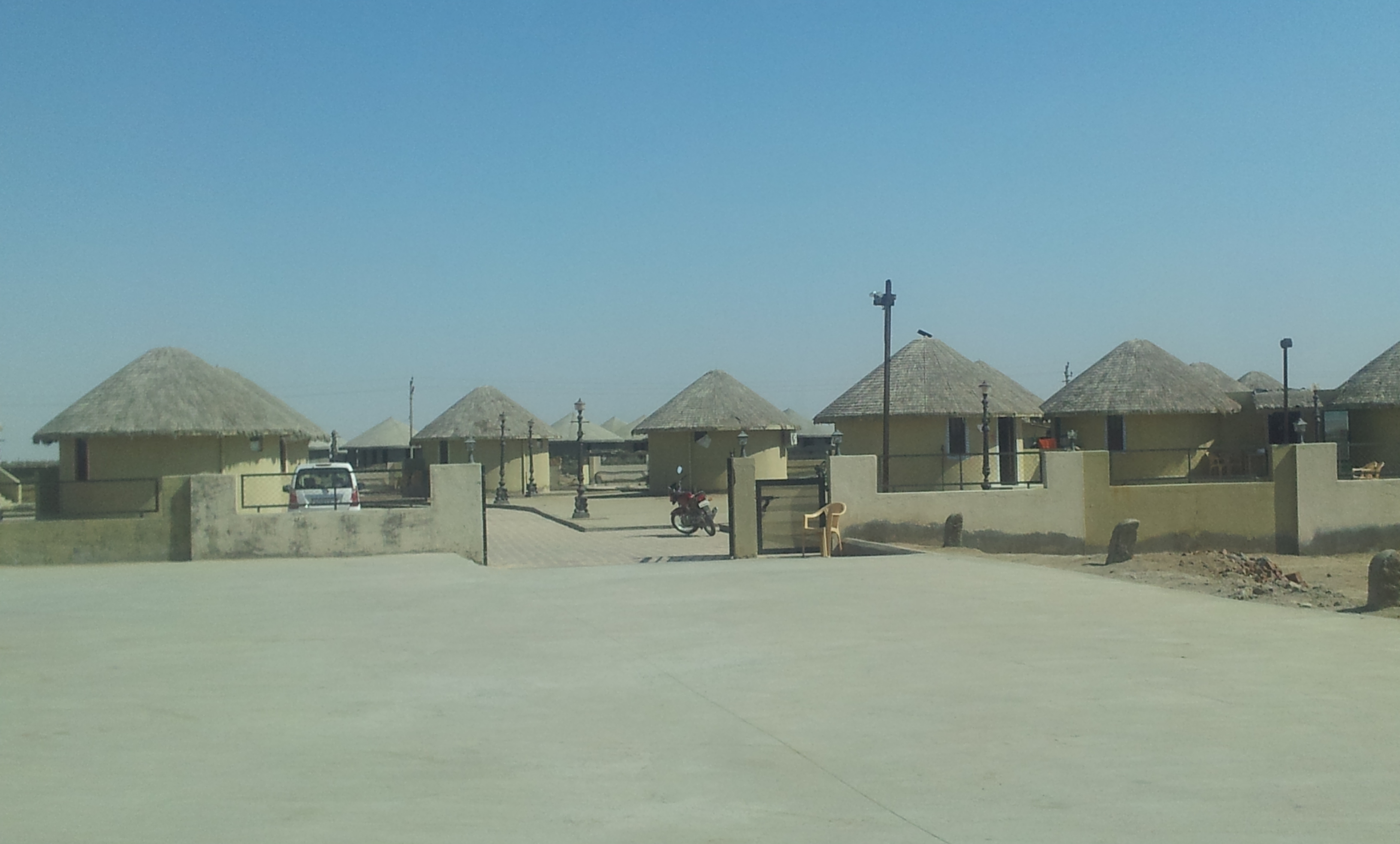
Dholavira is a small village. Its income from agriculture is almost nil. I wonder how people are living here in this desert. Hence the job of tourism dept does not end with good roads. It must be backed up with other facilities. And here comes the Toran Tourist Complex. We had called and booked a room at TTC when we were at Rapar. When we reached Dholavira, it was pitch dark.
We managed to locate the TTC and went there. It is a nice accommodation. With out the normal signing-in-the-register formalities, we were straightaway asked to get freshen up and come for dinner. We were only two people, but they served hot Gujarati Dinner. Everything was like a 5-Star treatment in this hostile desert. Hats off to the Manager Gaurang Dwivedi (02837 277395, 097277 23939, gaurangdwivedi14@gmail.com) and his team.
As said earlier, our mobile signals went dead once we were nearing Dholavira. It seems only few networks are available at some places and at some times. So don’t depend on mobile phones here. I wish the Tourism Dept does something about this as well as a petrol bunk, in the immediate future.
We had called a guide named “Jamal” about our visit. And in the TTC, we asked the room boy to inform Jamal about our arrival. There are two Jamals, one is a Senior and the other one is a Junior. Because of communication gap, the Junior Jamal became our guide. Hence I am not giving any guide’s contact number here. We asked Jamal to come tomorrow early morning to show us the Sunrise.
Today we drove 635 kms. Yes, believe me; we drove 635 kms, while seeing all the above mentioned places in Kutch circuit.
Were we tired at the end of the day? No, not at all. We had so much of energy still left, that we could have covered another hundred kms in such roads. So, that is Gujarat roads for you.

Notice the physical distance and the road-network between Kalo Dungar (Dattatreya Mandir) and Dholavira. As of now, there is no road here, but the work to construct a road in this white desert is going on. Once completed, it will be a big boost to the tourism of this remote place.
Total distance covered: 635 kms.
On day 15 of my Gujarat tour I explore the Modhera Sun Temple, Dholavira and the magnificent Rani Ki Vav in Patan.
Read previous day’s account| Read next day’s account
Related Posts


About The Author
B P Bhat
An avid traveler, BP Bhat is among few travelers, who instead of scratching the surface of a destination, prefers to go deep and wide to understand, explore and soak in the beauty of a place. His quest for travel has taken him to all extremes of main land in the Mother India; from Leh to Kanyakumari and from Guhar Moti to Kibithu. He likes to explore all the important tourist places in India, State by State.
Hello. Thanks for the route map and details about point of interest. This would help other travelers like me who are planning for Kutch trip.
Could you please let know if you were able to manage permits for Vigakot check post by walking in to Bhuj BSF headquarters? Or you had it done in advance through someone? Saw few posts in some forums mentioning that it is required to apply for permits one week in advance in person, hence the query.
Thanks